Go Tell It on the Mountain

A blog from the mountains of the Sinai

Bedouin navigation in Sinai

Wadi Mileihis, Go tell it on the mountain, Ben Hoffler
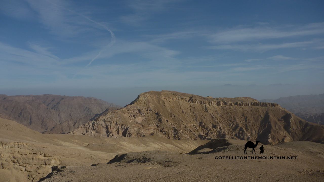
The Sinai has a reputation for being tricky to navigate. It’s the spot Biblical legend has it Moses got lost for forty years. History books report pilgrim caravans disappearing in the wilderness. Monks from the Monastery of St Katherine have gone wayward on mountain trails in recent times, as have hikers and inexperienced tour guides (who shouldn’t be guides at all). I often hear the Sinai described as a maze or a labyrinth (never by the Bedouin, always by outsiders) and I’ve heard people wonder awestruck at how the Bedouin navigate it, as though they must be possessed of a navigational sixth sense. At times, with the best Bedouin navigators, it can feel like they do have a sixth sense; but I’ll try and demystify exactly what that is in this blog post and how they do it.

There are a few things to say at the start. Firstly, although the Bedouin know the Sinai better than anybody in the world, they don’t all know it. The ones who know it exceptionally well and the best navigators are a small minority.

Most Bedouin know the Sinai averagely well at best (but it’s important to say this is still significantly better than the vast majority of outsiders).

It’s also important to say it’s still a lot better than most younger Bedouin. Many Bedouin – especially those under 30 years old – know the Sinai much less well than the generations that went before them. Many of the younger Bedouin would get lost if they walked far today and I’ve been with some who have done exactly that, relying on their camels to guide them the remainder of the journey (camels, incidentally, are all-too-often unfairly denigrated creatures with an incredible memory of routes they’ve walked in the Sinai, but this is another story).

That’s the reality of Bedouin life in the Sinai today. Most Bedouin – especially the younger generations – live in a more modern world where knowledge about how to navigate – as well as knowledge on how to use plants for food or medicine or to track animals or even knowledge about their tribe’s own heritage and history – is becoming increasingly irrelevant to life and thus forgotten.

The 21st century is the great age of attrition for Bedouin knowledge.

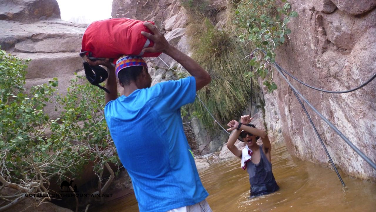
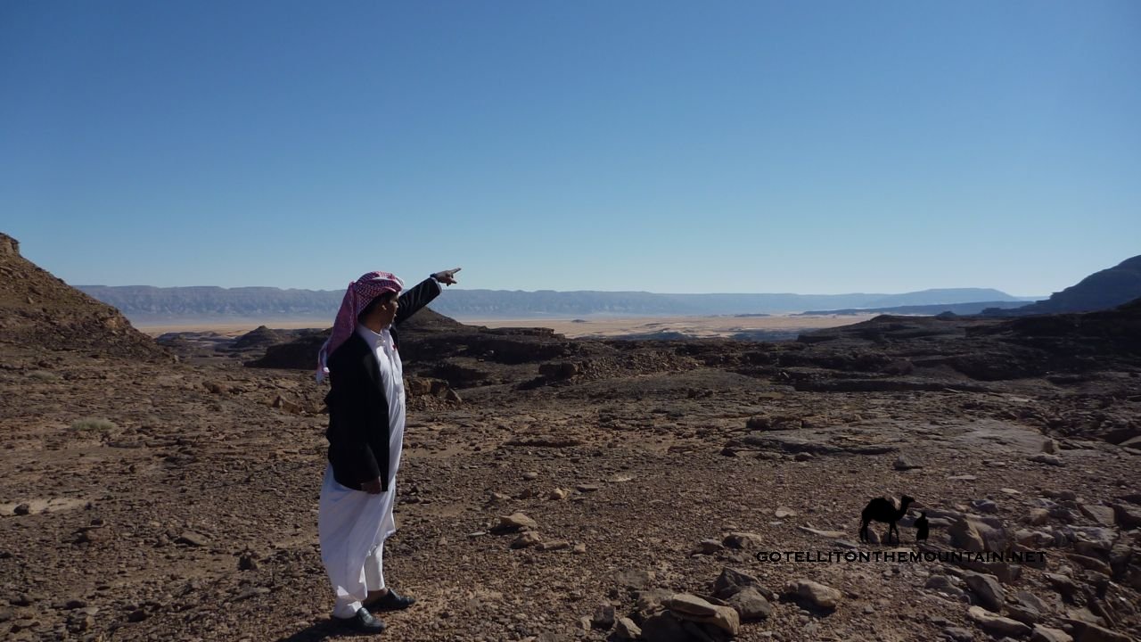
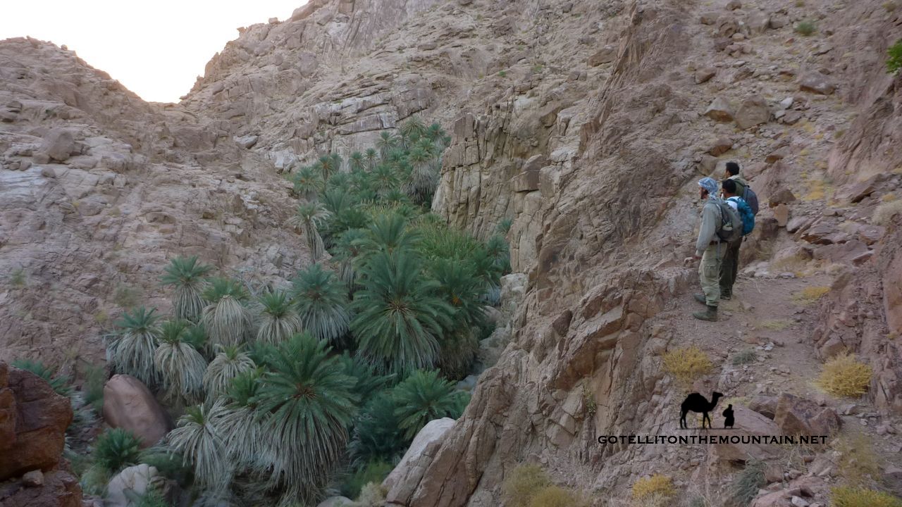
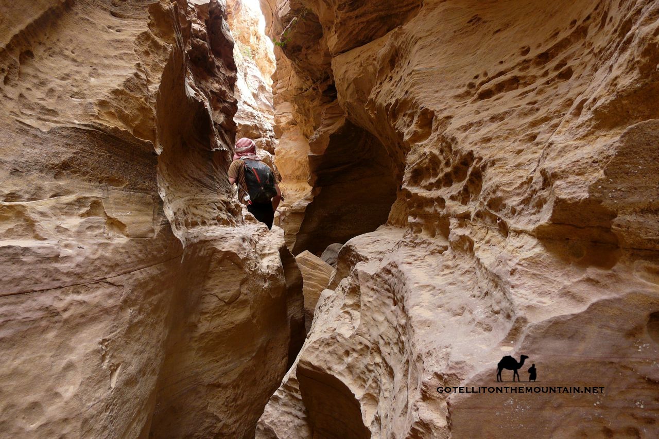
Second, it’s important to say that – even with the most knowledgeable of Bedouin navigators – their knowledge is usually confined to their own tribal territory. Take them to the territory of another tribe and they’ll know it much less well. A tribesman of the Jebeleya tribe from St Katherine won’t know the lowlands of the Tarabin tribe half as well as he knows his own high mountains. He may know the main wadis and mountains of the Tarabinian lowlands and may be able to navigate these but he’ll certainly miss a lot of the detail in between. This plays out on a smaller scale too. Often Bedouin will know a specific part of their territory – such as the one where they grew up – better than other parts.

Most Bedouin navigation – at least in South Sinai – is done from memory.

Nagb Matarsha, El Gardood, Sinai, Ben Hoffler, Go tell it on the mountain
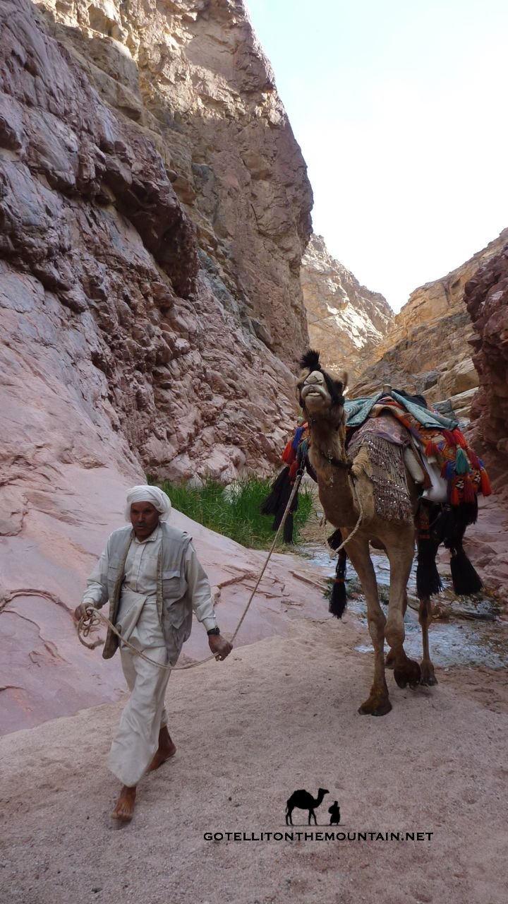
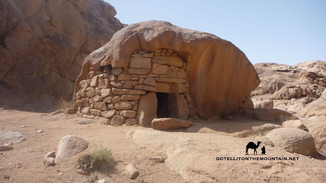
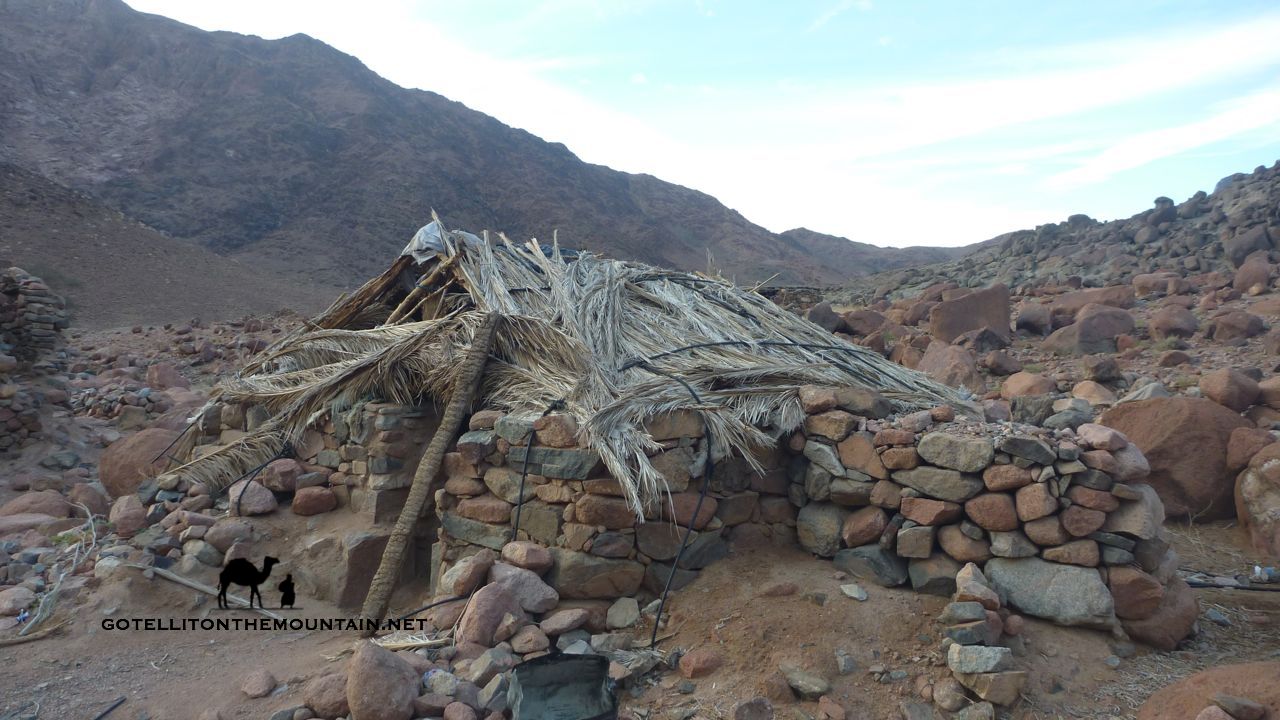
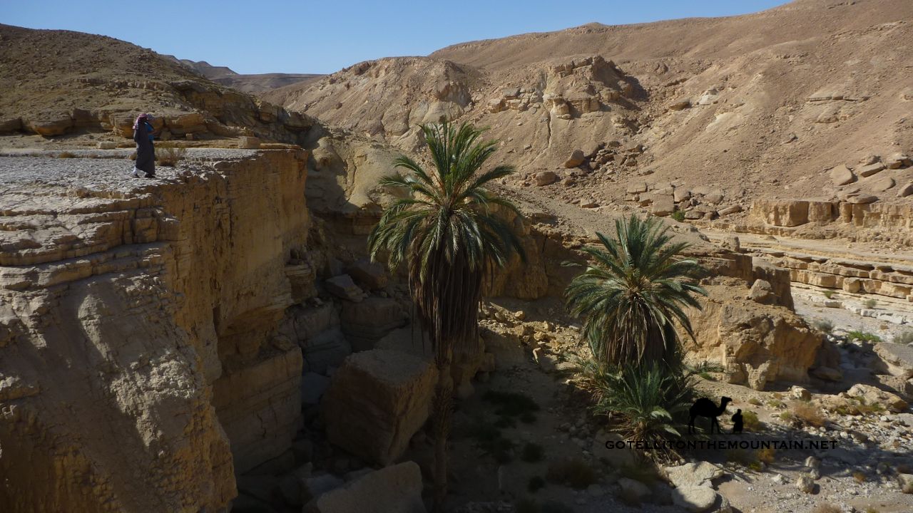
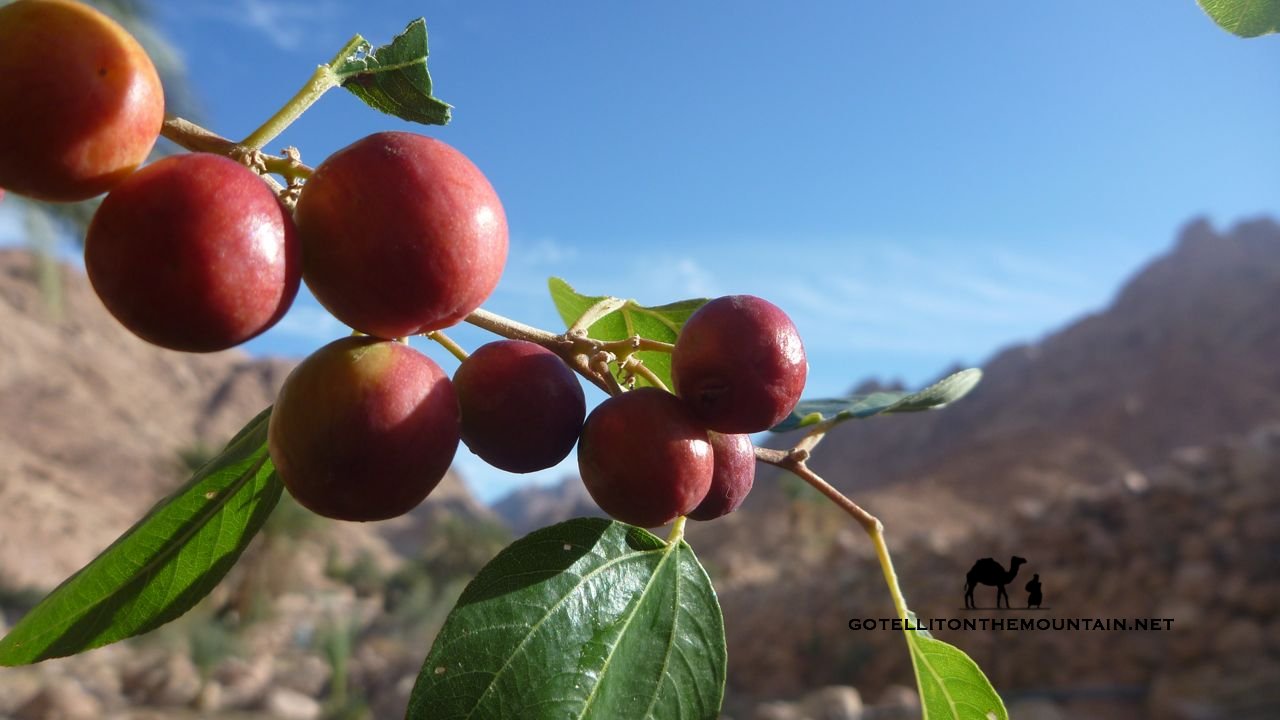
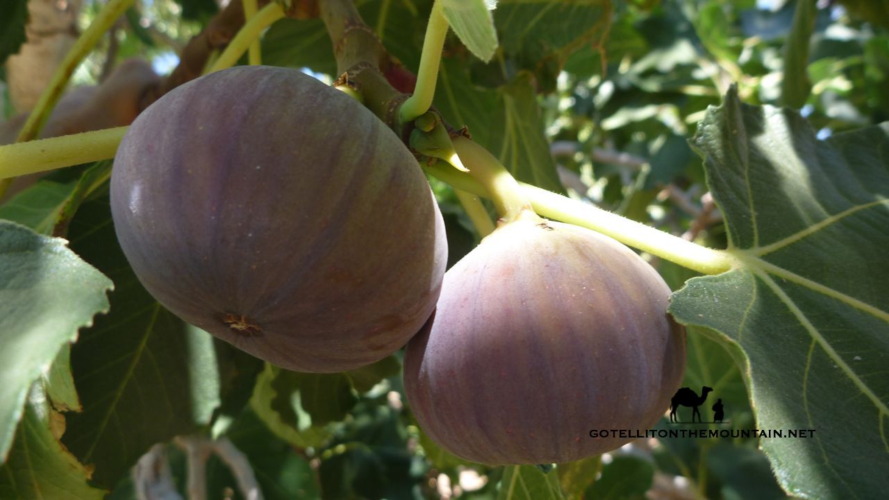
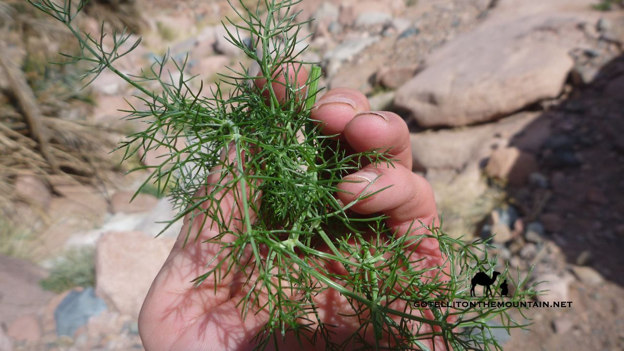
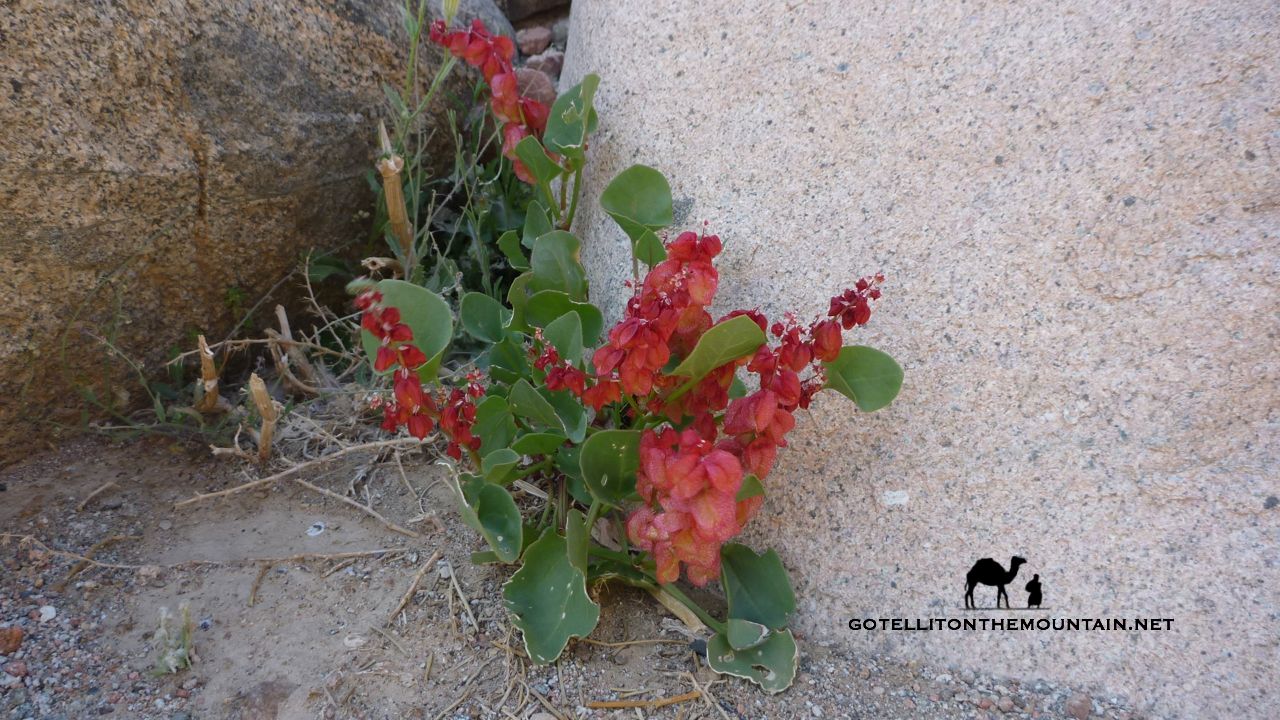
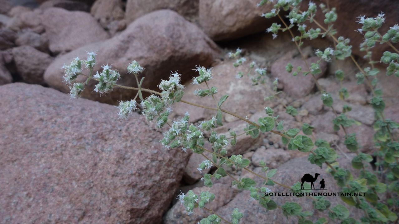
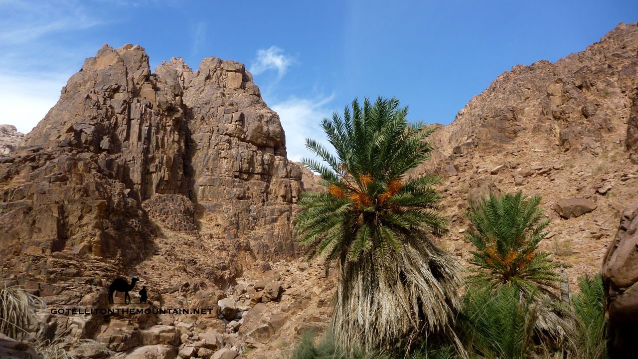
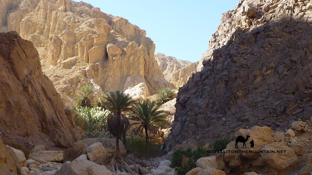
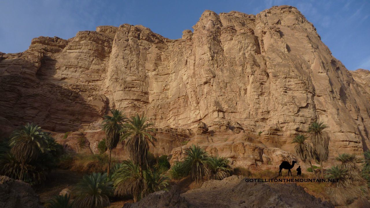
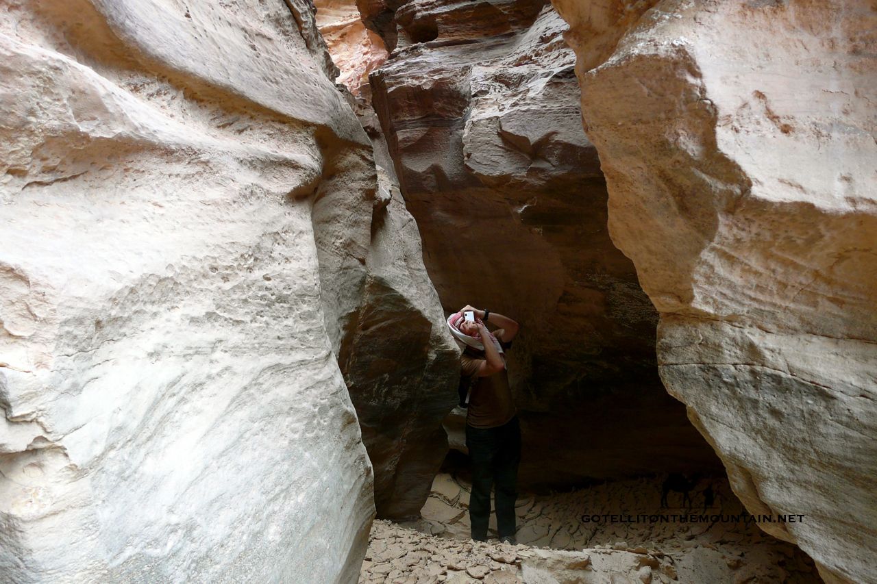
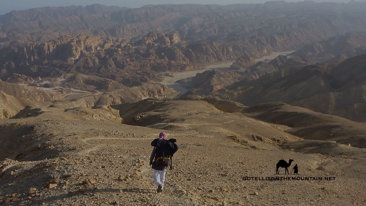
The Bedouin grow up walking; they walk with their parents, then increasingly on their own or with friends seeing the same landscapes repeatedly over many years and developing a deep familiarity with their small details and secrets. Over the years they build up an exceptionally rich mental picture of their territory; of what’s where and how to get there. Its mountain peaks, wadis and basins all act like gigantic reference points. These never change: they remain constant signs and waymarks for a Bedouin finding his way. Similarly, smaller, permanent signs in the landscape – a rock, or a fig tree; or a mark in a cliff – give more subtle reminders about where to go, where to turn etc.

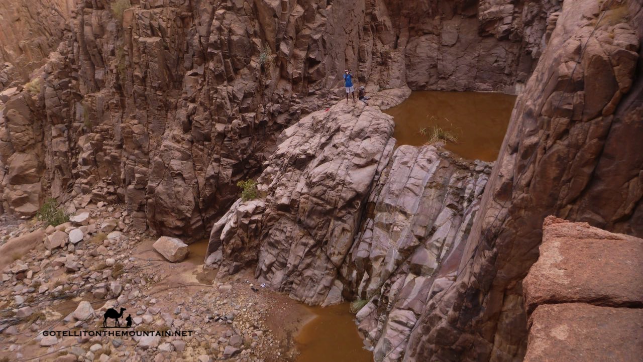
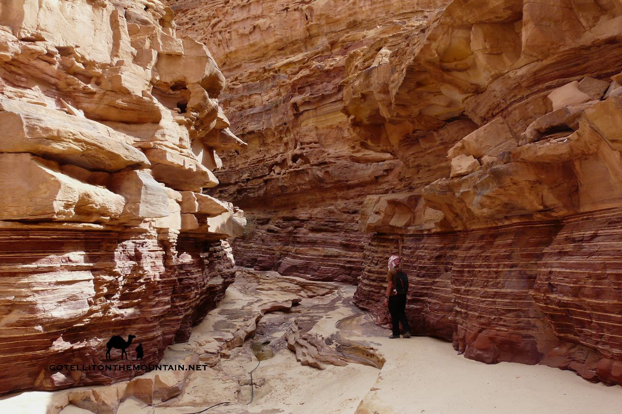
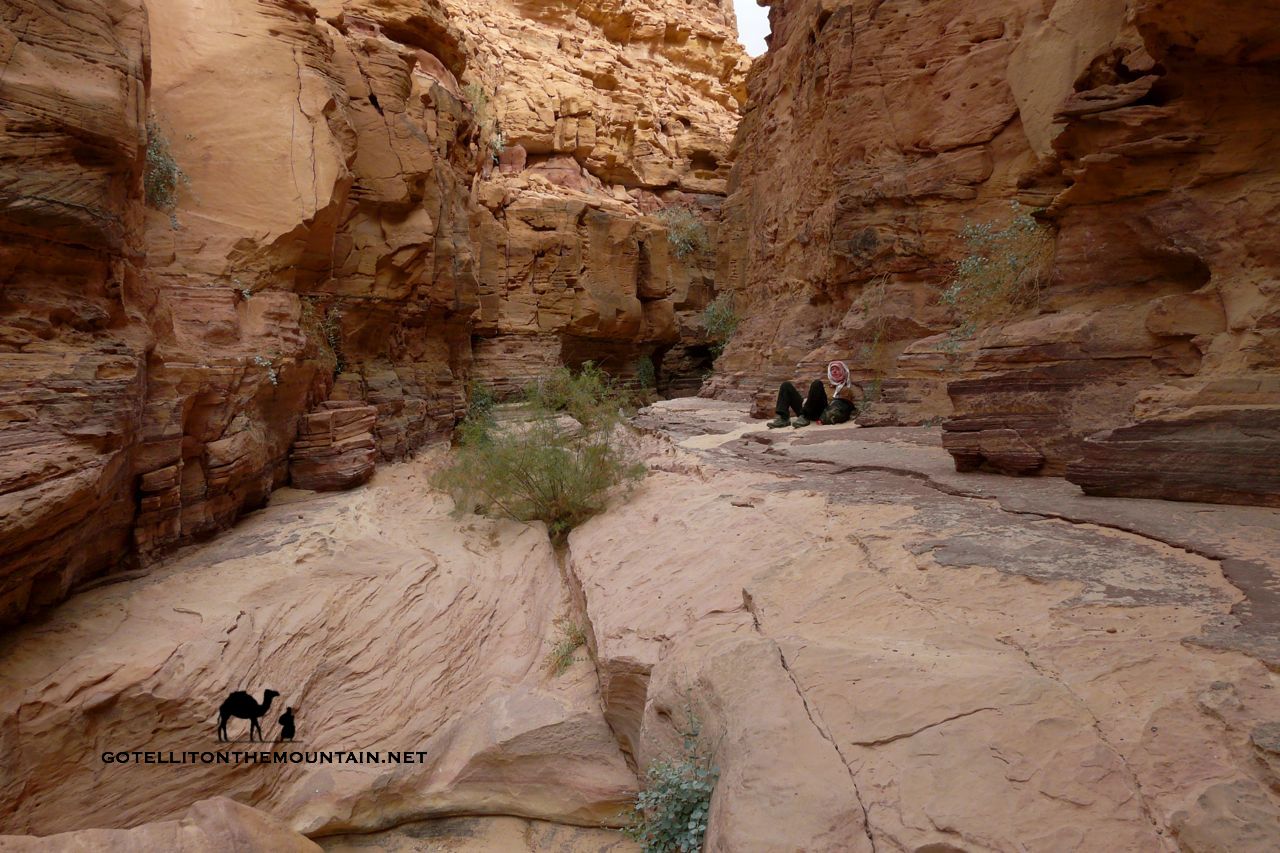
Sometimes, in places where navigation is tricky – e.g. a rocky, sandy areas across which there is no path – the Bedouin build trail marking stones called rojoms. You can see one rojom from the next, following them in a line through the difficult section. The best navigators won’t need these rojoms but they’ll be extremely valuable to the Bedouin who know the landscape at best averagely well. Following these is just like following a path (and of course there are plenty of paths in the Sinai, some of which are easier to follow than others, but all of which simplify navigating the mountain landscape considerably).

What about ways the Bedouin use to navigate indepedent of memory though? Independent of what they know from the ground itself?

In some parts of the Middle East the stars were key to Bedouin navigation, including parts of North Sinai. Here the stars and sometimes the horns of a crescent moon were important for navigating at night. Two stars were of special significance: Polaris (which the Bedouin call Al Jidi) and Canopus (which they call Suhayl). You’ll often hear references to these – and how they were used for navigation – in poems and stories. Polaris was a constant guide to north, visible all night, all year, whereas Canopus – which indicated south – was less constant; it wasn’t always visible and when it was it’d often remain on show just a couple of hours. But this was mostly in North Sinai.

Things were different in South Sinai. I’ve never seen a Bedouin use the stars in the south and although many older Bedouin will know how to find north and south from the stars I’ve only heard of the stars being used to find the way here in the most exceptional of places and circumstances.

There are several reasons why North and South are different in this respect.

Wadi Sig bamboo thickets, SinaiGenerally, the stars are best for navigation in landscapes that can change – e.g. vast sandy deserts like the deep Sahara, where the wind can alter the shape of dunes, cover rocks and outcrops and blow any trails away. Or in landscapes that look the same; ones that are bereft of good landmarks and where it’s difficult to distinguish one part from the next, such as plains and low dunes common in North Sinai. The visual appearance of the land or at least human judgement of it can’t be taken as a good enough indicator of the way to go in these places which forces us to look outwards for other, more constant elements that give us more reliable guidance, like certain stars.

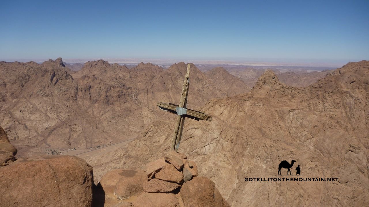
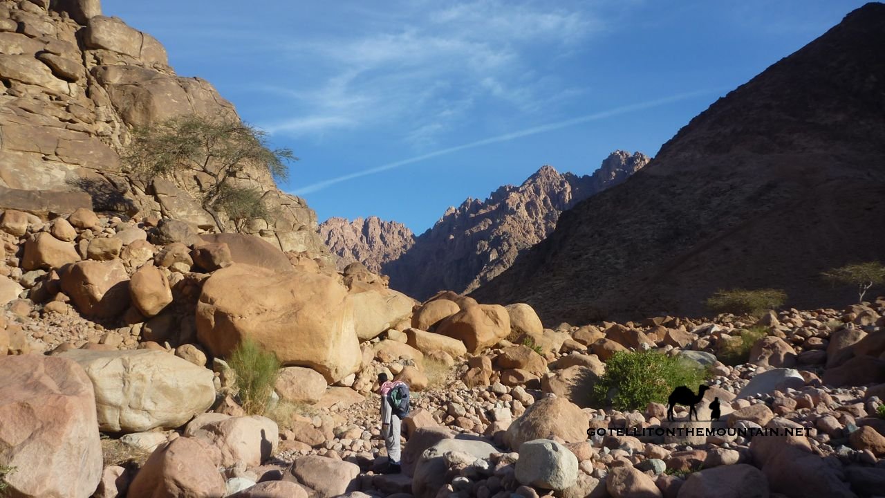
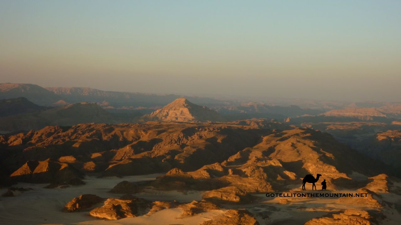
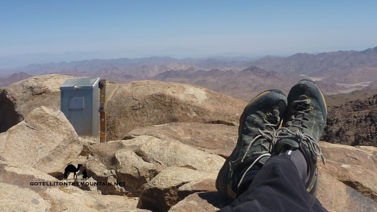
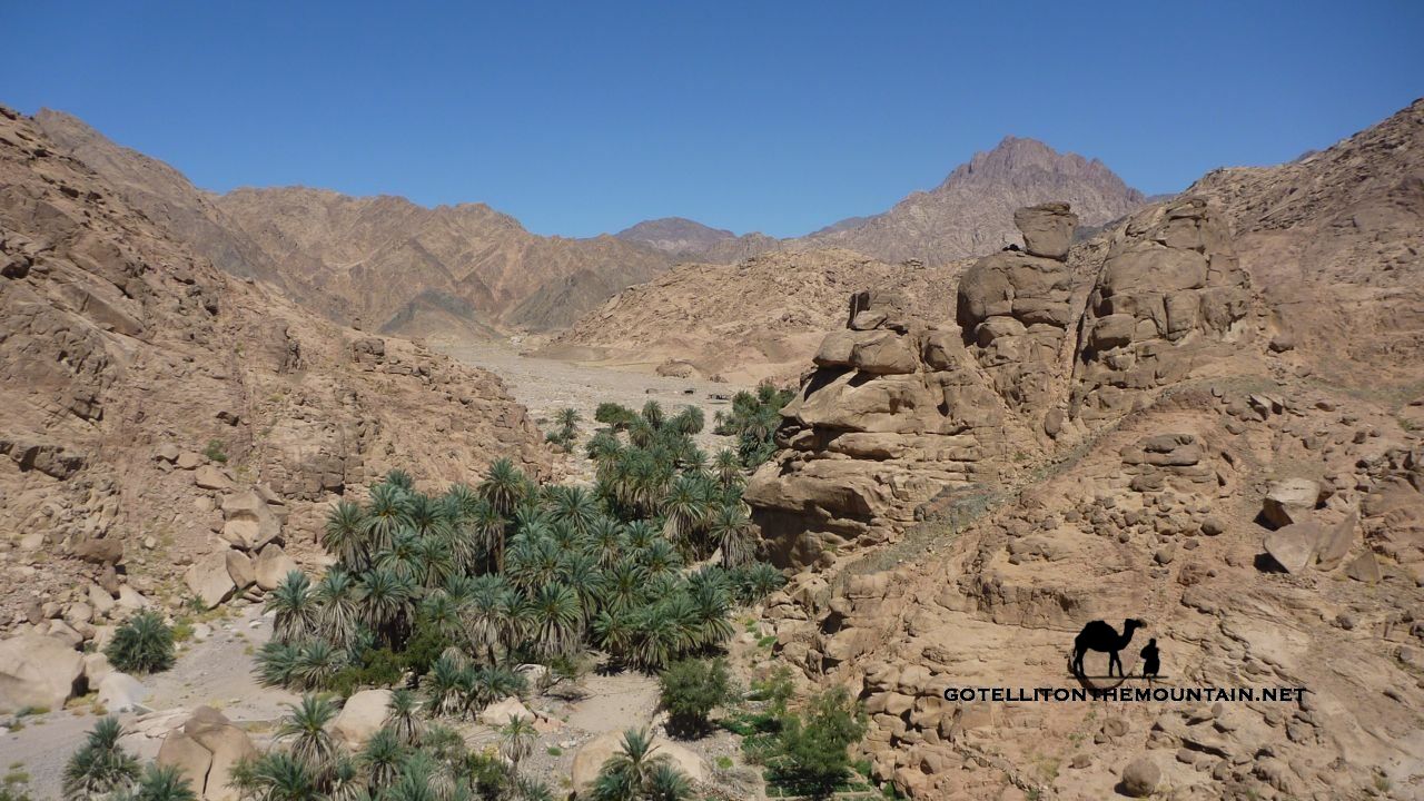
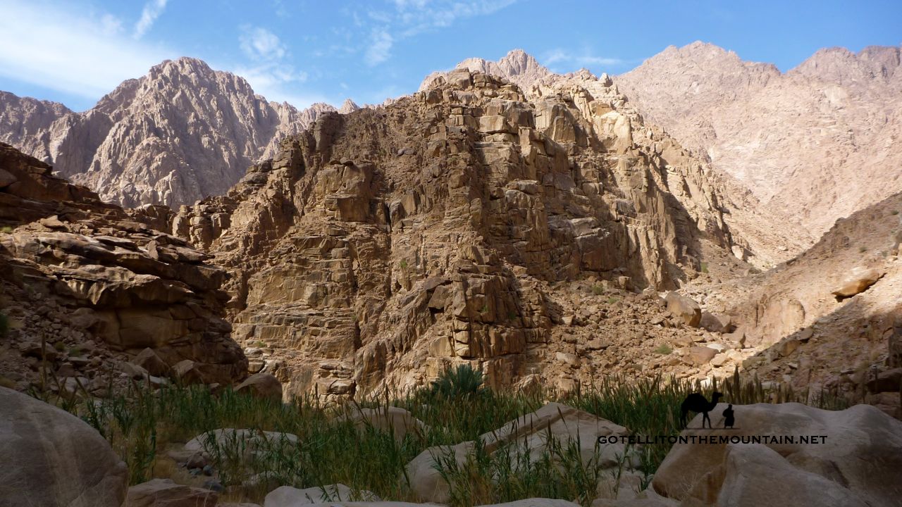
That’s different to South Sinai though. Unlike the North, this is chiefly a landscape of mountains and stony, rocky deserts with outcrops. It has a rich supply of markers that remain unchanging between the generations and which are ample to guide any good Bedouin navigator where he needs to go.

The Bedouin of South Sinai would have about as much reason to use the stars to navigate as a resident of Cairo would going between Zamalek and Maadi.

Simply, it’s unecessary. Better, easier things tell you the way.

Navigating with the stars also has serious limitations in a landscape that’s as intricate as South Sinai. Navigating here isn’t simply about identifying north and going for it in a straight line, like it might be in open deserts or plateaus or out on the sea. Big mountains get in the way in South Sinai. There are deep wadis to cross. There are high cliffs you can fall off. In landscapes like this the stars and the moon are more useful for the light they can throw over the landscape when they’re shining brightly rather than the directions they indicate. Getting through places like this is about micro navigating the intricate terrain of the mountains on routes that are winding, tricky and difficult to follow.

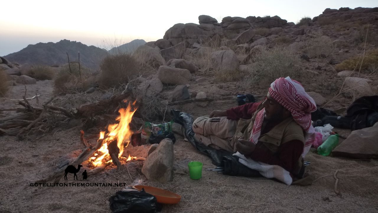
When I hear people say the Bedouin use the stars to navigate in South Sinai – especially now, in the 21st century – I know that i) either they know very little about the Sinai or the reality of navigation in it or ii) they do but they push this myth anyway because it sounds romantic and plays into outsiders’ – and especially Western outsiders’ – fantasies about who the Bedouin are and how they live that for whatever reason they want to capitalise on; it makes them sound exotic, with magical, esoteric skills, and an air of oriental mystique. I see this orientalising drive in bad travel writing and dodgy full moon party ads about the Sinai and – as appealing as it is to the imagination – the bulk of it isn’t true. Today, the reality is that many Bedouin – including some of its best navigators – are people who listen to mp3s, have smartphones and Facebook accounts; they watch TV shows, download stuff off the internet and spend hours on YouTube. And indeed why shouldn’t they? Why should this make them less Bedouin? Why should we maintain a description of the Bedouin that outsiders find romantically pleasing but which is out of date (assuming it was ever accurate at all)? Describing them in a more accurate and up-to-date way bursts the romantic vision many have but perhaps that isn’t a bad thing.

Up until now then it’s clear that – in South Sinai – the Bedouin navigate chiefly by getting to know specific areas exceptionally well; by building up a very rich mental map over many years that out-competes what anybody else could have and recognising the signs that mark the way.

It all sounds very visual and most of the time the vast bulk of it is.

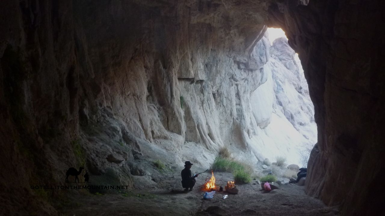
Perhaps what sets the very best Bedouin navigators apart is their ability to use other senses – ie senses apart from sight – to know the way. Sometimes, this is necessary; especially in the high Sinai mountains, which can be hit by poor weather. Sometimes, mist and cloud whip across the mountains, reducing visibility; even so, visibility is very rarely so poor that a Bedouin navigator wouldn’t be able to see what was needed to make judgements about where to go. The worst conditions I’ve seen in the Sinai were on top of Jebel Katherina in freezing weather at night when visibility was just a few metres ahead.

Weather like this makes navigation much more serious. It makes it harder and it introduces a more unknown element into the equation which can spook some people and lead them into making bad decisions.

Nevertheless, a good Bedouin navigator would still be able to get through this. He will be slower; he will need to think and focus more, but the very best will nevertheless be able to deal with it and find his way through.

So how does he do that if he can’t see where he’s going?

Again, it all comes back to that exceptionally rich mental map a Bedouin has of a particular area: without sight, he needs to rely on other senses to interpret that map and locate his position on it. Whilst he might not see the ground he’s standing on, as he moves over a mountainside he’ll be able to feel the contours of the slope he’s on with his feet and balance: he’ll be able to feel where it gets steep and where it becomes flat; similarly, where it gets smooth, or rough, or where he walks onto scree. Each of these pieces of information is key and he will be able to use them to locate himself and proceed correctly. If you closed your eyes in your house and focused, you might be able to slowly find your way to the bedroom, feeling your way, using the same basic principles. It would’t be as easy as doing it with your eyes open, but it would be possible.

As well as the sense of touch the best navigator – again through his experience of having walked these landscapes so many times will have a sense of distance and timing built into his mental map. He will know how long it takes and feels to walk from one part of it to the next, even when doing it more slowly – for example in bad weather – and will be able to get a sense of where he is.

These techniques are similar – if less formal and exact – to the ones we’d use in the West to navigate in low visibility conditions.

Bedouin with fire, Ben Hoffler, Go tell it on the mountain, Jiddet el alaWhen you wonder how the Bedouin navigate the Sinai – and I mean South Sinai here – remember, it’s chiefly about an extremely rich mental map. It’s about building up that map over many years and being able to interpret it intelligently through different senses as required. The way the Bedouin seem to ‘know’ the way even in the night or difficult weather might seem magical: but I hope this shows a bit of how it’s actually done. As for how outsiders in the Sinai, for all but the most experienced navigators you’ll generally need to use other methods (guidebooks, maps, GPS, Google Earth or a combo of these). Really though, the best plan is to use one of the best Bedouin guides/ navigators; because when you really need them, they are about as good as it gets keeping you safe through the Sinai. Nothing else comes close.

Continue Reading

Chasing the summer rain…

Canyoning Sinai, Ben Hoffler, Go tell it on the mountainA couple of days ago, I was sitting in a cafe in St Katherine, sipping a cup of tea when big, Biblical thunder began echoing around. I walked outside to see what was happening and saw dark thunderclouds gathering over Jebel Abbas Basha – one of the big mountains near the town – and then smelt the scent of rain, carrying in the breeze. Over Jebel Abbas Basha the clouds burst, the heavens opened and a deluge fell; soon, the water level rose and a flash flood went tearing down through Wadi Shagg, on the western side of the mountain. Then, down to more distant wadis. People who saw it – including a Bedouin guide who was in Wadi Shagg with two foreign hikers at the time – said it looked incredible; a huge, raging river of sand, boulders and dead shrubs.

The Bedouin call summer rain like this a sarookh – meaning ‘rocket’ – because unlike rain in winter, which usually comes from clouds that cover bigger areas – this comes from isolated clouds, hitting more specific spots.

The rain this summer was an absolute textbook example.

As the Bedouin name suggests this rain is often the most dangerous. First of all, because it comes so suddenly, with little warning. Secondly, because when it comes, it’s usually heavy, fast and violent; meaning the flash floods grow more quickly. If you get stuck in a wadi when a sarookh hits the best thing you can do is to climb the sides as quickly as you can. If you’re stuck in a narrow canyon whose sides you can’t climb, you can be in real trouble. In fact, you need to be vigilant all the time for this sort of rain through the hotter times of the year because although it might be beautiful weather where you are a sarookh might have hit a wadi upstream of you, sending a flood your way…

This time around, thankfully, everybody was OK in St Katherine. And also in settlements downstream, which the flood later tore past…

Waterfall, Wadi Shagg, Go tell it on the mountain, Ben HofflerThis was my first time being near summer rain in the Sinai and I was annoyed to have not actually seen it. The next day I went to Wadi Shagg to see what it had left behind though. Everything looked beautiful. Red rockpools lay between the boulders, with small waterfalls between them. The sound of running creeks echoed around the sides of the wadi. The tracks of birds covered big, shining flats of mud – which were rippled like waves – as they dried slowly in the sun. Dead shrubs sat on top of boulders…

It was the best I’ve seen Wadi Shagg looking and all the better because there had been no good rain here for at least a year. I went back to town to get a couple of friends. The three of us went on an adventure up the bottom of the wadi, wading through waist deep water and clambering up waterfalls – the perfect way to cool off in this most sweltering of sweltering summers. At the top of the wadi we found a huge pool – the biggest I’ve seen in the mountains near St Katherine – below a dripping tongue of sediments left behind by previous floods. We ate, swam and then followed the path of the flood back to St Katherine, passing Jebel Abbas Basha in the night, under a crescent moon.

Canyoning Sinai, Go tell it on the mountain, Ben HofflerQuite apart from making these wadis look beautiful and giving brilliant canyoning-type adventures this rain is good news because the Sinai really needs it. Wells and springs are getting lower and everything is dry. Right now, in Wadi Shagg, tree roots are submerged in water and the animals have a place to drink. And it wasn’t just Wadi Shagg. Two other mountains – Jebel Tarbush and Jebel Serbal – also had rain. The Bedouin say more might be on the way this summer too. If you want to escape the heat of Cairo – or Dahab or Sharm – there’s nowhere better than Wadi Shagg. I reckon the waterfalls will stay a couple of days and bigger pools over a week. Just remember to look out for another flood. You never know, lightning might strike the same wadi twice…

Continue Reading

Old ways to St Katherine

Crucifix, Sinai, Go tell it on the mountain_resultStand by the Monastery of St Katherine today and look around – swivelling through the full 360 degrees – and you’ll see high mountains locking you in on every side. Leave the monastery behind and venture up these mountains, heading for the very highest tops, and another – even more spectacular – view unfolds. A vast desert wilderness stretches out all around you, merging into the haze of faraway horizons. Sometimes, you can even see the high places of Africa and Asia. It’s a view that gives a sense of the Sinai’s epic isolation – the great no man’s land between continents – and of the Monastery of St Katherine; which stands in the most isolated part of the Sinai itself. Visiting the monastery today is easy – you can drive right up to its front gate – but getting here once required a long, gruelling camel expedition through remote stretches of wilderness.

The monastery might have been isolated, but it was still accessible. Travelling routes converged on it from all sides; some from Cairo, others from El Tur – an important port – and others from Jerusalem. Pilgrims, traders, travellers, warriors and poets all followed these ways before. And you can do exactly the same today.

Here are my five favourites – the best hiking routes to St Katherine.

Wadi Isleh, Go tell it on the mountain_result1. WADI ISLEH One of three big wadis that cut through the gigantic chain of mountains that run down the Sinai’s west coast. It’s spectacular from the start – a canyon whose walls rise vertically to the sky. Waterfalls gush and palm trees stand buried to their heads by the sediments of old floods. This was the way from the old port of El Tur – (today’s capital of South Sinai) – and the main route upon which supplies reached the monastery. It became important after the Islamic Conquest, when other routes became difficult. It takes 3-5 days and is best done in spring, so you see the waterfalls at their fullest. Water in the desert always has a magic about it.

Wadi Sig Sinai, Go tell it on the mountain_result2. WADI MIR This gives an alternative way through the massive chain of mountains on the west coast. You soon get to a junction in the wadi where two routes diverge. One goes to Wadi Sig – my favourite wadi in the Sinai – whilst the other crosses a high pass known as Naqb Umm Seikha. This was the fastest, most direct route and as such the one along which post travelled to St Katherine (it was called Darb el Bosta – The Post Road). It’s another way in from El Tur – and to save your energy, you can even get a jeep a few kilos up the wadi. It takes 3-5 days to St Katherine but – be warned – it’s tougher than Wadi Isleh.

Naqb el Hawa, Go tell it on the mountain_result3. WADI HEBRAN The third of the big three wadis cutting into the Sinai’s huge western chain of mountains. It’s full of greenery and was the wadi through which Abbas Pasha – an old ruler of Egypt – planned a road to St Katherine. Today, talk of making a new modern road has resurfaced, which is all the more reason to walk it now. You have two options: you can exit the wadi on a route that connects to the old pilgrim route of Naqb el Hawa: Pass of the Winds. Alternatively, you can continue to Wadi Kabrin – a beautiful red rock wadi with Christian graffiti and hermit cells. Either way, give it 3-5 days start to finish.

Serabit el Khadem, Bedouin guide, Go tell it on the mountain_result4. DARB MUSA – the ‘Way of Moses‘. This is the legendary way to the Monastery of St Katherine from Suez, re-tracing the way it’s said Moses escaped the Pharaoh Ramses. It was the major route upon which travellers walked to the Monastery of St Katherine in times past and is recorded in several early guidebooks. Travellers would visit ‘Stations of the Exodus’ on the way – where it’s said Biblical stuff happened. Today, it’s best not to start in Suez; but in Wadi Gharandal, where Wadi Wutah gives a beautiful passage through the Wilderness of the Wanderings to Wadi Feiran and St Katherine. Give it 7-10 days all the way.

Ras El Qalb5. THE JERUSALEM ROUTE The route carried a steady flow of pilgrim traffic – connecting two major Christian sites in the Middle East. It entered the Sinai from the Negeb – the Sinai’s Bedouin sisterland to the north – and ran into Wadi Watir (which has a tarmac road today – but which is still beautiful). There were two routes into Wadi Watir – one down the coast from Taba – and another from further north. Thereafter the main route passed Ein Hudera; a green oasis with pilgrim graffiti. Today, a variation on this route is being re-made as the Abraham Path and will soon be ready. Give it 10-12 days to walk the whole thing end to end.

Remember all of these routes are walkable but they go through remote, isolated stretches of wilderness where help can be a long time coming if needed – so a good, experienced Bedouin guide is key to success. Going with the Bedouin is the smart move and it will add a whole new dimension to your trip. You won’t just get to know the way – you’ll really understand the desert and how to survive it. As well as a guide you’ll need to take a jeep to the beginning of most of the routes marked here. For the first three wadis the best place to start from is El Tur. For the fourth, you’ll need to get the jeep to Wadi Gharandal. Check out the best guides and jeep drivers in my Directory of the Best. Most of them will know the routes here and if they don’t they should be able to link you up with other trusted guides who will.

Continue Reading

The Sinai: cool places to sleep

Bedouin with fire, Ben Hoffler, Go tell it on the mountain, Jiddet el ala‘Spread a blanket beneath an apple tree and it’ll only gather apples’ wrote French author Antoine de Saint Exupery in Wind Sand and Stars. ‘Spread a blanket beneath the stars’ – he carried on – ‘and it’ll gather the dust of stars’. Like the Bedouin, he was a man who loved the desert; especially at night. He liked to lie back, face to face with the universe, gazing up at the glittering heavens and immersing himself in a picture of eternity. I’m sort of like that. Sleeping under the stars – out in the open, without a tent – is about as good as it gets for me. The Bedouin call it the ‘million star hotel’. And I’m totally with them. When I go back to sleeping inside I feel trapped with a roof over me. Tents can be good sometimes – like in winter – but I still don’t usually carry one. Neither do the Bedouin. They like to travel light, finding shelter if they need it. And sometimes, you DO need it. Sometimes it’s cold or windy or raining or whatever.

Luckily, the Sinai has plenty of shelter. A cave, an old shepherd’s house; a hermit cell, a rock with a hole under it. Basic – yes but with a beautiful, epic, lost age feel.

So here are the COOLEST places to sleep if you’re on a hike:

Ghoul's Cave, Sinai, Ben HofflerCAVES – there’ll always be something cool to me about sleeping in a cave. I actually enquired about renovating and living in a cave near St Katherine once (alas, it didn’t work out). Sleeping in a cave puts you inside the landscape. It makes you feel part of it. Caves are always atmospheric, especially with a fire at night. The cave in the pic is Kahf el Ghoula – The Ghoul’s Cave – on Jebel el Rabba. It’s OK but a bit damp and if anything too big to really get warm. My favourite caves to sleep in are in Wadi Maghara, near Wadi Feiran; actually, they’re not caves, they’re ancient mines from Pharaonic times. They’re great shelter and gaze out over a beautiful sweep of mountains.

Hermit cell, Sinai, Go tell it on the mountain_resultHERMIT CELLS – these might be the Sinai’s best spots to sleep. They’re basically boulder houses built over a thousand years ago by Christians seeking refuge and solitude in the wilderness. Some are more advanced than others, like the one in the pic. You can see my red bag next to the door. Walk in and there’s a big porch where you can leave your stuff and make a fire. Crouch down and a little wooden door lets you into the main chamber which has sleeping platforms, shelves and air vents. It’s near Jebel Bab el Dunya and I slept here for two nights in a heavy snowfall in December 2013. There are other good ones on Jebel el Deir, Mount Sinai and in lots of other secret mountain spots.

Boulders, Wadi Kidd, Go tell it on the mountain_resultHOLLOWS & HOLES– go to the desert parts of the Sinai and you’ll find landscapes with a surreal, Salvador Dali type vibe. Some of the rocks look like they’re melting in the sun, with strange droops in their sides and psychedelic swirls of colour. It’s all because of the way the sandstone erodes here; occasionally, the erosion creates bigger hollows into which you can crawl and use as sleeping pods. Some even have holes in the side, like windows. The best are on Jebel Mileihis. But they’re hidden well – so you’ll have to hunt. Higher in the mountains, you don’t usually get the same sort of thing; the closest equivalent are holes under big boulders, like in the pic above.

Rock shelter, Farsh Umm Silla, Sinai, Go tell it on the mountain_resultBEDOUIN SHELTERS – the Bedouin built an extensive network of shelters in the Sinai. They’re like hermit cells but they’re not usually as ancient and the Bedouin didn’t live in them long term either. They were built for Bedouin travellers or for ibex hunters – who still use them today. There are also old storehouses, which the Bedouin used for storing brushwood and provisions for when they needed them. They’re well hidden and just look like a small door in the cliff. Storehouses are usually a bit small; but if you really need shelter you can still squeeze inside and use them. My favourite shelter is near Jebel el Thebt; a totally hidden boulder house in a remote, windswept wadi.

Sinai hut, Go tell it on the mountain, Ben HofflerHUTS, HOUSES & RUINS – OK, a hut doesn’t have the rugged charm of a cave, but these are still pretty cool places to sleep. Some huts are owned by the Monastery of St Katherine and usually have a crucifix on the door. There are old Bedouin houses too; four stone walls with a palm fond roof, still sometimes used. If you find people inside, they’ll always welcome you the Bedouin way. I reckon the best are in Wadi Sigillia, a wadi with waterfalls. Finally, look out for old ruins. Few have roofs but they give good windbreaks. And you sleep inside history itself. Not many folks can say they’ve slept in a Byzantine monastery or Ottoman Palace – unless they’ve been to Sinai…

Finally: an obligatory word to the wise. Shelter in the Sinai isn’t always easy to find; often, it’s hidden, because the Bedouin like it that way. You can walk past an amazing shelter, mistaking it for any old rock. Most of the Bedouin know where shelter is because they know the area. If they don’t, they know how to find it. Or make it. Before hiking without a tent – which gives cover anywhere, anytime – check the weather forecast and know where the shelters are. As well as knowing where the shelters are also know how to find or make one in an emergency. There’s nothing better than a good Bedouin guide to keep you safe – so do your research and use one. Finally, remember to leave shelters as you find them; and, if you can, to leave some useful stuff behind – e.g. sugar, tea, wood – because you never know, the people who follow you might really, really need it…

Continue Reading

El Gardood: the Gulf tableland

El Gardood, Sinai, Gulf of Aqaba, Go tell it on the mountain, Ben HofflerWalk inland from the Gulf of Aqaba coast – anywhere between Ras Shetan and Taba – and you’ll enter chain after chain of rugged coastal mountains. Carry on – following the wadis that snake between these mountains – and you’ll soon reach the bottom of a gigantic cliff: a huge natural foritification to the Sinai’s beautiful desert interior. Getting up it isn’t easy. Everything’s loose. There are big drops in places. If you hold your nerve and climb it though, you’ll emerge on one of the Sinai’s great natural wonders. A high desert plateau where you can gaze over the Gulf of Aqaba – the watery ribbon of blue – to the Hejaz mountains of Arabia. You can see cities like Hagl in Saudi Arabia and Aqaba in Jordan. Ocean liners look like tiny dots, never moving on the waves.

I’d been to the bottom of this plateau before. But I’d never gone up. I’d never heard anyone talk about it either. Not until a maverick Bedouin friend called Musallem called me a couple of months ago anyway, saying we should make a route over it for a new trail called the Abraham Path.

If you haven’t heard about the Abraham Path check it out HERE. It’s a new long-distance walking trail in the Middle East, lately voted the No. 1 trail in the world by National Geographic. The aim is to develop sustainable economies for local people, boost adventure tourism in part of the world that gets more bad press than any other, and get people walking, talking, and understanding the region better. It’s the most ambitious hiking project ever started in the Middle East and will be a major milestone for the region when it’s finished.

Musallem and me have been helping here and there with the Sinai part. Last year we nailed down a 200km route from Ras Shetan to St Katherine. By doing this plateau, he reckoned we could add an extra 30km too, opening up a new trekking area in the Sinai and spreading the benefits to more communities.

El Gardood, jeep, Go tell it on the mountain, Ben Hoffler, SinaiAs it turned out, Musallem had been up here before. Actually he’s been pretty much everywhere in the Sinai. At least in the desert. He goes to the places where virtually nobody else ever goes. Because they’re there. Which is one of the reasons I like him so much. He hadn’t just walked this plateau either. He’d ridden a mountain bike over it (probably the first person in history ever to even think of riding a mountain bike across it). Anyway, we arranged to do it, finding a hiking route that’d cross the plateau and connect to the route we already had further south. The first time we did it, we drove inland from the coast, circling round to the interior side of the plateau, where it’s easier to get up.

A strong wind blows over the edge of this plateau at night, rushing down to the sea. It’s nearly 1000m in altitude too, which makes it extra cold. We slept up here, waking to see frost clinging to the retem bushes and our sleeping bags wet with dew. We huddled over the fire, warming our hands before leaving the jeep behind and heading south on foot, mapping the trail.

When most people think of mountains in the Sinai, they think of Mount Sinai: a dramatic granite highlands type of landscape with bulging bronze cliffs and smooth whaleback summits. When it comes to the mountains of the Sinai, plateaulands like this are much more common though.

As mountains, or highlands, or whatever we should call them though, they cover more of the peninsula in area size. And they’re almost as high as some of those peaks of the Mount Sinai area too. Some are nearly 1500m high.

P1300375_resultOf all these plateualand mountains the most popular with trekkers is one called Jebel el Gunna. The most famous is Hadabat el Teeh: the Biblical Wilderness of the Wanderings where legend has it Moses walked for 40 years. El Gardood – as they call this plateau along the Gulf – is the most little known of these highlands. For what it’s worth (and as someone who’s walked all of these highland plateaus) I reckon it deserves much more attention than it gets though. Whatever merits the other plateaus have, standing up here and looking over the Gulf to the Arabian Peninsula is one of the Sinai’s great views. Gazing down over the sea and looking at four countries at once makes it feel like you’re standing on a gigantic map of the Middle East. It’s all there, spread out before you.

We took a whole day finding our way across the plateau that day, walking 28km through deserted basins and rugged passes until we got to its southerly edge. This was exactly where we needed to be to connect this new trail to the southerly one we’d already put down the year before. And a good path ran all the way down.

The next week – gluttons for punishment that we are – we went back to do the whole thing again, only this time with someone from the Abraham Path. And this time, there was no cheating with a jeep. We needed to find a way up onto the plateau from the sea – and a way through its foreboding cliffs – which we finally did. Actually, there are a couple of old trails; or rather, remnants of old trails. They have been damaged by repeated flash floods over the years so they’re tricky.

Ein Shefalla, Go tell it on the mountain, Ben Hoffler_resultUp on the top, walking on the flats, we took the same route over the plateau as the first time. This time though – taking notes and making route guides – we took our time with everything. We also explored a few new areas of the plateau. One of the best spots we saw was an oasis called Ein el Shefalla; just a few palms below a high cliff, but a real beauty of a spot. Nearby – where the water plunges from the high cliff into the sands after rain – is a dry hole where you can dig to get water. The Bedouin call a hole like this a themila. Start digging and after a while, you’ll smell the water, seeping through the sand. Soon, the water seeps into the hole, which you can scoop up. Or sponge it in a shemagh.

The more I walked up on El Gardood the more I liked it. It’s different to the Sinai’s other plateaus. Grander, with massive highland chunks. Its wadis are deeper. And greener. Everywhere feels much lesser trodden. There are no footprints. No litter. It’s easy to find firewood, because so few people ever use it.

It’s also like a window back to the more ancient times.

Look carefully and you’ll find blackened fireplaces and stones marking out Bedouin sitting places. There are old cemeteries with graves pointing towards Mecca and old storerooms in the cliffs. Once upon a time, El Gardood was where the Bedouin came to graze their flocks in the springtime.

Nagb Matarsha, El Gardood, Sinai, Ben Hoffler, Go tell it on the mountainThat second time on El Gardood we walked all the way out: down from the plateau, into the the sandstone desert, then out of the coastal chains to Ras Shetan. Everything said, it was mission accomplished: we’d connected the two trails. The guys at the Abraham Path are busy developing trail guides right now – along with lots of other great stuff – and I’ll update the blog when they’re ready. Look out for the trail as it’s going to be great. If you want to do El Gardood before the trail’s finished, you can. There’s a lot to explore and discover. Just be sure to go with a good Bedouin guide: my tried and tested tip is Mussalem. Take it all in and remember it too. Because once places like this get discovered and put on the map, they don’t stay secret for long…

Check out this Google Map I made of the rough area of El Gardood.

Continue Reading

Wild foods of the Sinai

Nabug, Sinai, Go tell it on the mountain_resultWhere I grew up, we got most of the food we ate at a supermarket, walking the aisles and picking it off the shelves. When I came to the Sinai and began walking with the Bedouin my relationship with food – what I ate and how I got it – changed. We’d still buy food in town before leaving for the mountains. Out on the trail though, the Bedouin would always be scanning the ground for other stuff to add to the general supply. Whenever they saw edible plants, they’d have a trailside nibble. They might keep some for a later meal. Sometimes, they’d pick more, to take home. Except for a few wild blackberries I never really ate like that back home. In the Sinai though, watching the Bedouin, I had the privilege of learning what I could eat, how I could find it myself, where and when.

Eating wild food feels good. It’s liberating not to pick it off a shelf. Not to have to pay for it. It can be fun. It tastes a bit different too, which is new. More than that, it feels like a rediscovery. Foraging was key to human survival from early times, but we lost the knowledge needed to do it centuries ago in Europe, as we settled in towns. Discovering it again feels like reclaiming an old birthright.

The Sinai isn’t overgrown with food. Plant cover is patchy at best so you have to look carefully and take your opportunities. It’ll rarely be enough alone. But it’ll be a brilliant supplement to help you stave off the hunger pangs.

So here are my ten all-time favourite wild foods of the Sinai.

Ficus carica, Teen Baree, Fig, Sinai Ben Hoffler1. WILD FIGS There are two types of fig tree in the Sinai, but the fruit of one is much better than the other. It grows in the high mountains and, occasionally, in mid-altitudes of the desert, and ripens in July. For me, it’s the Sinai’s best wild treat. You can dry the figs if you’re out a long time too.

Foeniculum Vulgare, Fennel, Shamar, Sinai, Ben Hoffler2. FENNEL A plant with stringy, feathery leaves and a strong aniseed flavour, this can be eaten as you find it. It won’t fill you up like fruit, but it’s a still a good trailside nibble that’ll stave off the hunger pangs. You usually get it in rocky mountain areas, mostly in the lower elevations.

Dates, Sinai, Balah, Ben Hoffler3. DATES From the date palm, a high energy food, perfect for walking. You get them mostly in oases or lower lying wadis. Finding a bundle of dates is a blessing that’ll keep you going for days if you need it. Sometimes the dry and shrivelled dates on the floor are a sweeter, better snack.

Athman, Sinai, Ben Hoffler4. ATHMAAN A high rush-type plant with a feathery tip. Each stalk is a series of inter-connected parts; pull gently between these parts until one slides out of the other. The moist, fleshy stuff inisde is edible. It’s not much. But it wets your mouth and tastes OK. You usually get it in sandy areas.

Crataegus Sinaica, Sinai Hawthorn berries, Ben Hoffler5. HAWTHORN BERRIES These are the berries of the Sinai Hawthorn: they’re small and red, with a pip and not much flesh, so you have to grab a handful to make it worthwhile. They make a brilliant trail snack to nibble on though. The trees grow in rocky, shadowy gullies in the high mountains.

Rumex Cyprius, Homath, Ben Hoffler6. HOMATH One of my favourites. You can eat its leaves. They have a sharp, lemony taste and chomping into a clump in the desert sun is always refreshing. You can cut them and add them to salads too. You can also boil the leaves, then strain them and eat them in soups or even with sour goat’s milk.

Zaatr, Oregano, Sinai, Ben Hoffler7. OREGANO A common mountain herb. This grows on rocky hillsides and the Bedouin use it a lot. It’s hot and spicy if you eat it raw and alone. It’s best sprinkled over cheese, salads, with olive oil etc. You can dry it too, then grind and mix it with pepper and salt as a flavouring for other food.

Zizyphus spina christi, Nabag fruit, Sinai, Ben Hoffler8. CHRIST’S THORN The Bedouin call this nabag. The fruit is a small, red berry, about the size of a marble. I don’t like it straight off the tree; like with dates, the dry fruits from the ground are better. They’re good, sugary nibbles, perfect for snacking. The tree grows mostly in mountain wadis.

Mentha Longifolia, Horsemint, Habag, Sinai, Ben Hoffler9. HORSEMINT The perfect addition to tea and therefore a Bedouin favourite. A few leaves in your glass gives tea the wild mountain touch. You can eat it too, but it’s strong. It grows near water – remember that, you might need water! – and you’ll often smell it on the breeze before you see it.

Capparis cartilaginea, capers, Sinai, Ben Hoffler10. LASSAF Caper fruit and the biggest fruit on this list. Cut it in half and scrape the yellow flesh off, levering it over your bottom teeth. Gulp it down whole. Don’t munch it. The seeds are hot and will make you retch. Swallowing it whole, it’s sweet and delicious. It grows out of cliffs and rocky walls.

Here are the Latin/ English names for these plants. All the ones I know, anyway. I use the Bedouin names in the Sinai. If you know any of the missing names, please drop me a line so I can update this blog post.

ENGLISH BEDOUIN LATIN
Wild fig Teen Beree/ Hamaat Ficus carica
Fennel Shamaar Foeniculum vulgare
Date palm Balah/ Nakhl Phoenix dactylifera
Sinai Hawthorn Zahroor Crataegus sinaica 
? Athmaan ?
? Homath Rumex cyprius
Oregano Zaatar Origanum syriacum 
Christ’s Thorn Jujube Nabag Ziziphus spina christi
Horsemint Habag Mentha longifolia 
Caper Lassaf Capparis cartilaginea

Remember, eating wild foods has potential risks. Some plants in this list have lookalikes and are easy to mistake with others. Some plants are poisonous too, so you need a Bedouin who really knows what they’re doing. Don’t use this list as a definitive field guide, because that’s not what it is. Please remember too, plants are key to the ecosystem and although nibbling one here or there is generally OK, you should be responsible with it. Don’t go harvesting wild plants for use at home. Just nibble them if you really need them.

Continue Reading

Three Peaks Egypt: the intel…

Walking group, Jebel Abbas, Three Peaks Egypt, Ben HofflerOver the last few months, I’ve been part of a team developing the Three Peaks Egypt Challenge, a new 38km hiking trail in the mountains of the Sinai. It’s Egypt’s first mountain challenge and the only Three Peaks Challenge in the Middle East. Well, it is so far, anyway. Hopefully we’ll see other ones. The whole trail is a community initiative. Its aim is to showcase the beauty of Egypt’s mountains and to revive some of the tourism that’s crashed so disastrously here since Egypt’s revolution. We want it to bring a trickle of hikers through the mountains, to help the local communities. Anyway, so far we’ve produced maps. There’s a GPS track. And route guides. We’ve got a website up and running. All that stuff is free and you can get it HERE.

Since then, the emphasis has been on walking and re-walking the challenge in a general intelligence gathering exercise; figuring out its secrets to advise hikers with the best tips and to find the best ways of supporting challenges with guides, camels, accommodation for the local community etc.

Growing a trail is like growing a tree. It’s a long process and we’ll be working on this for years to come. Anyway, I’ve been able to reflect a bit on the first phase a bit lately. So here’s what I know about the 12 and 24 hour options.

THREE PEAKS EGYPT: 24 HOUR CHALLENGE 

Three Peaks Egypt Challenge, Go Tell it on the Mountain, Ben Hofler_resultI reckon this will become the classic way to do the challenge. It’s manageable if you have a good level of fitness and stamina and walk it the right way. The first guy to do it was a 57 year old engineer called Leo who walks barefoot in the Alps and who’d taken a month-long walkabout in the Sinai prior to the challenge. He got round in an impressive 16 hours and 6 minutes. Also with us was Olivia, a PhD grad studying bee pollination in the Sinai who took a generally dim view of the whole Three Peaks Egypt Challenge, telling us she’d done all three peaks before and saw no good reason doing them again, especially not on the same day, and that she was coming for a nice walk and would retire half way around. Which is exactly what she did, despite our best protestations.

OK, so here are my main impressions and top tips for the trail:

1. Slow and steady. Go slow and steady. Look on yourself as playing the part of the tortoise in that old fable about the tortoise and the hare. The hare tears off to the horizon, then relaxes and sleeps, letting the tortoise overtake to finish first. You have to be the tortoise. You don’t need to go super fast. You can go slow. But you have to keep going. You have more time on this challenge than you might think. We set a manageable pace all the way along and took breaks for tea, lunch, pictures etc. Go too fast and you’ll burn out too early.

2. Night hiking. This is unique to the 24 hour challenge. Don’t underestimate it. The paths are loose and uneven and you have to stay 100% focused to avoid a tumble. The darkness also makes it harder to judge how far you’ve gone, how far you’ve got to go etc. Everything feels further. It’s a psychological thing. Take a headlamp and spare batteries. Or hike in spring, when the day is longer. Try to get to Farsh Umm Silla on Jebel Katherina before dark too: just before it is a scrambling section that would take much longer at night.

3. To sleep or not to sleep? I was sorely tempted. There was the hiking hut on Jebel Katherina. A Bedouin tent at the bottom. Cushions. A fire. A hot meal. Actually, we’d planned to sleep here. But then Leo piped up wanting to head up Mount Sinai. Maybe a short power nap on the spot would help. Anything more though, probably not. Setting off after an hour was tough enough. Waking up, pulling on a backpack and pressing the muscles back into service up another mountain would have been a tall order indeed.

4. Small, light meals. We had really good meals. They gave us energy and were a chance to relax and make plans on how to finish. They say the best plans are laid with a full belly. I’d add the caveat that executing those plans with a full belly – especially on a 38km mountain challenge – is another matter entirely. I ate seconds and thirds on this challenge. And I paid the price. I felt like an anaconda that had swallowed a calf afterwards, hauling myself up the mountain. My top tip: eat smaller meals and energy snacks like dates, halawa, chocolate…

5. Know how it works. Ask your guide how the logistics of the trail will work before you do it. This will help you plan each stage. If you’re in a group, a camel will usually meet you half way. That means you can think of it as a game of two halves; carrying lighter loads on each. Know the water points too. There’s more water on the first half than the second, so you can go lighter on the first, drinking water on the way. This will preserve your energy; travelling lighter will also be better for your feet and knees. You’ll feel better.

THE 12 HOUR CHALLENGE: EXTREME  

Three Peaks Egypt, Go Tell it on the mountain, 12 hours, Ben HofflerA Bedouin man-of-steel called Salem – born at the foot of Jebel Katherina – was supposed to be doing this. Until he got laid low by a stomach bug. Then I was the next in line. Generally, these extreme sort of challenges aren’t my thing. And generally, since school, I’ve had the knack of being in the wrong place at the wrong time when the dubious chance of doing one comes around. Cross country races. The 1500m. Half bloody marathons. I’ve been roped into all of them. History repeats itself. I hardly slept before this: I never do when I’ve got to get up early. Especially not with a 38km mountain challenge looming over me like the Sword of Damocles. Anyway, this was tough: but definitely not impossible. I took 9 hours 28 minutes and 30 seconds. Watch a video HERE.

OK, so here are the main things I’d say if you’re doing it.

1. A fast walk – not a run. You can do this as a fast walk. I ran less than 300m. My plan was to start it as a walk. If I was doing OK, I’d carry on; if I was lagging, I’d run. I got to the half way point in four hours. After that, I knew I’d be OK. Beware though, time is bearing down. It’s breathing down your neck all the way. So although you can do it as a walk, you have to keep going. I took six rests. Most were 3 minutes. The longest was 7 minutes. It’s like being the tortoise again. This time though, a sort of thoroughbred racing tortoise.

2. Use the daylight. You’ll have at least 12 hours of daylight in the Sinai, even in winter. Which means you should be able to do it all outside darkness, as long as it goes to plan. The 12 hour challenge isn’t one for the dark…

3. Watch the clock. Time ticks mercilessly away on the challenge, indifferent to your suffering. Make all the time you can in advance. I didn’t take many pictures. I didn’t stop to eat. I didn’t rest much. I put my chocolate bars where I could grab them. I opened the corn beef before I left. I put some TANG in an empty bottle, so it’d be ready when I re-filled it. I put new batteries in everything. Think of what will take time, then cut it out, minimise it, or do it at home. A lot of this challenge is about strategy and having a tight game plan.

4. Choose company wisely. If I’d been with somebody faster I’d have felt I was holding them back. And I hate that. It would’ve been a psychological burden for me. If I’d been with someone slower on a challenge like this, I’d probably have felt held back myself. Alone, it was 100% my pace and my plan. Company can be good, but it depends. If you go with a partner, make sure you’re well matched: that you can tolerate and laugh about each other’s shortcomings.

5. Know the challenge. Knowing every twist and turn meant I didn’t waste time. I knew where I was going. I knew where to get water. I knew those sections where I could go quicker. The downhill stretches. The better paths etc. My top tip is to walk the whole trail before your challenge, figuring everything out.

6. Eating and drinking. No big, heavy meals this time around. I ate on the move. The chocolate bar count was 12. I ate two slices of corn beef. I drank four litres of water. The annoying thing was drinking through a tube. I borrowed a bladder bottle with a drinking tube that dangled round my chest, thinking it was a good idea. Actually, sucking water through a tube messed with my breathing rhythmn. To use an Americanism, it sucked. Literally. So I abandoned it, carrying a small 750ml litre bottle in one hand and reverting to the traditional method of pouring it down my oesophagus when I was thirsty.

7. The pain barrier. Four months ago, some eegit dug a hole outside my front door in St Katherine. I fell into it and didn’t walk properly for a month. Half way through this challenge I couldn’t put my foot down. I thought it was the old injury: actually, I’d strapped it too tight. That was the first pain barrier. Later, the accumulative battering took its toll. Knowing my pace count I reckon I took at least 53,200 steps on the hard, rocky paths. My feet really felt it. The balls and heels. At the end, my body did too. In fact, it felt like my 32 year old self had been reincarnated in my 80 year old self’s body. So be prepared for it to hurt a little…

Admiring the view, Three Peaks Egypt, Ben Hoffler_resultOver the coming weeks we’ll be working all the information into the website, so if you’re serious about doing it, have a look. I haven’t talked about the 72 hour challenge here but that’s also an option. Good for the blazing heat of summer. Or for other inclement weather. And if a challenge event isn’t your thing you can do the walk as a normal hike, in whatever time is comfortable. In the coming months, the next phase here will be setting up a system through which a hiker can do the challenge easily and independently. And it’ll be about finding businesses – ethical, responsible sorts of businesses – that can offer the challenge to people, bringing more people to the local economy and helping the region. Contact me if you need any info on the whole thing!

Continue Reading

Sinai: five beautiful oases

P1270565_resultThis blog is mostly about mountains. I love getting to the tops of mountains. I love how they represent the last point between the earth and the sky; the last place we can go and the most natural end to a journey we could ever make. If there’s a single moment though – a single, iconic moment – that rivals getting to the top of a mountain, it’s arriving in an oasis. And I mean arriving in an oasis after days in the desert. When you get to an oasis, suddenly, there’s shade. Suddenly there’s water. You can hear the birds. You can smell the fires. You get handed tea. It’s that moment of knowing you’re out of the wilderness; that, just for a moment, there’s sanctuary and you can breathe easy.

When you go to one by jeep you’ll see it; but you’ll never really understand what that little clump of green means in the wider context of a desert. Oases are made special by what’s around them and by the journey you make to them.

I’ve already talked about my five favourite wadis in the Sinai. Here are my five all time favourite oases too. What are yours?

Ein Hayalla, Ben Hoffler, Go tell it on the Mountain_result1. EIN HAYALLA My favourite of all, I first spotted this from high on Jebel Madsus; far below, it looked like an emerald gem buried in the red rocks. It’s a cluster of green palms in one of the heads of Wadi Kabrin, with deep water pools and trickling creeks. There are bamboo tunnels and fallen tree trunks you can walk across like bridges. Long ago, this oasis was on a pilgrim route to St Katherine; you can still find Byzantine pottery and crucifixes etched on the rocks. One amazing way to walk here is via Wadi Hebran, from the coast. There’s a similarly spectacular route via Wadi Sig, but it’s longer. And harder. You can also walk in via a place called Baghabugh, from St Katherine.

Ein Shefalla, Go tell it on the mountain, Ben Hoffler_result2. EIN SHEFALLA You won’t find many folks who’ve been here. Half way up a deserted wadi that drains El Gardood – a high, foreboding plateau that flanks the Gulf of Aqaba – it’s just a couple of palms below a vertical cliff. It’s not the lush jungle of Ein Hayalla. But the surroundings are much harsher. And that’s why this little patch of green means so much here. It has a themila too: a hole where you can dig down to find water. Walking to Ein Shefalla isn’t easy. You can do it from Wadi Guseib, on the Gulf of Aqaba coast near Bir Sweir. It involves a tough hike over a hard-to-navigate plateau for which, like all the oases here, you’ll need an experienced Bedouin guide.

Ein el Guseib, Sinai, Go tell it on the mountain, Ben Hoffler3 EIN GUSEIB This little oasis huddles at the end of a rugged coastal wadi, below the El Gardood plateau. It’s a haven of green with palm trees, bamboo, pools and creeks that run through the sands. It’s a beautiful spot that you can get to with a walk from the beach. From Bir Sweir on the Gulf of Aqaba coast – roughly 25km north of Nuweiba – follow Wadi Guseib inland from the beach. Otherwise, you can do it at the end of a longer trail passing three of the oases here. Start near Ras Shetan and from here walk to Moiyet Melha (see below). After this you can climb up the El Gardood plateau, crossing it to Ein Shefalla and down its rugged coastal cliffs to Ein Guseib and the Gulf of Aqaba.

Moiyet Melha, Ben Hoffler, Go Tell it on the Mountain_result4 MOIYET EL MELHA They say a ghoola – a sort of evil witch – guards this oasis, maiming or killing anybody who traps its animals, cuts its trees or tries to claim the oasis for himself. Some are scared of her; others see her as a benevolent force of nature. A guardian who protects its animals and trees against human greed. Moiyet el Melha is a long line of green palms that grow at the bottom of high cliffs, where water seeps out. Getting here isn’t too tricky: it’s at the end of a long coastal wadi called Wadi Melha, which starts near the beach camps of Ras Shetan. Half way along is Wadi Wishwashi, a spectacular ravine. The oasis is near the end of the wadi; a beautiful spot to sleep.

Ein Kidd, Sinai, Ben Hoffler Go tell it on the mountain_result_result5 EIN KIDD The only oasis in this list where you’ll find people. Sometimes, I like having places to myself. Other times, people add something. After days in the wilderness, it can be good to talk again. At least, it can with the right people. Getting stuck in an oasis with the wrong people would be a problem. Ein Kidd is in the territory of the Muzeina tribe and the Bedouin here are hospitable in the old school traditions. The oasis itself is a cluster of palms in Wadi Kidd, a long wadi that connects the St Katherine region with the coastal ranges. It’s a sort of half way house on treks between St Katherine and Sharm and it can also be tied into longer treks from the Jebel Umm Shomer area.

Check out the Google Map below, to pinpoint the oases. Remember, these spots are in remote, rugged mountain country and it’s essential to take a Bedouin guide who knows what they’re doing. Check out my Directory of the Best.

Continue Reading

The secret canyon: Abu Hamata

Abu Hamata Canyon, Sinai, Go tell it on the mountain, Leo LaimerOver the years I’ve been walking the Sinai and talking to the Bedouin, I’ve heard a few stories about a little-known canyon, hidden deep in one of the most remote parts of the peninsula. Some said it was the Sinai’s longest canyon. Others said it was the most beautiful. Whoever described it gave it an air of secrecy and mystique. Known as Abu Hamata – Place of the Wild Figs – it’s a spot only a few Bedouin know. Yesterday, I went to check it out with Leo – a guy who’s just returned from an epic, month-long walkabout in the Sinai – and a Bedouin friend of the Jebeleya tribe from St Katherine, who’s also a two-time Abu Hamata veteran.

Getting there isn’t easy. It’s in a little-known tract of desert below Hadabat el Tih, the gigantic table land that runs from one side of the Sinai to the other, forming the great natural divide betwen North Sinai and South.

Rain that falls north of the plateau’s edge runs down to the Mediterranean.

Rain that falls to the south – into canyons like Abu Hamata – runs either to the Gulf of Aqaba or the Gulf of Suez.

As wilderness settings for a canyon go, this is about as good as it gets.

Abu Hamata Canyon, South Sinai, Leo Laimer, Go tell it on the mountainThe wilderness that surrounds Abu Hamata makes the whole thing more of an adventure. Doing a canyon in the middle of nowhere will always be more exciting to me than doing one that’s easy to get to. And the wilderness doesn’t just add adventure: it has a sort of moat-around-the-castle effect that has fortified it against the mass tourism that has been so harmful to some of the Sinai’s other canyons. There’s a stillness and solitude and peace in this place that it’s hard to find in other spots. Entering it feels like walking into a gigantic natural cathedral or mosque.

Coming from the St Katherine or Dahab side you follow a long, winding jeep track over harsh sandstone badlands before reaching a single palm tree in a long, sandy wadi, which marks the point you start walking.

To begin, the walk-in to the canyon is nothing spectacular.

Further up, the walk is interrupted by a small waterfall cliff near some wild fig trees. The canyon takes its name from these. Scramble over this cliff and you can continue in the sandy wadi until you reach a point that looks like a cul-de-sac.

Carry on though and you’ll see it’s no cul-de-sac at all. It’s a sharp turn to the left: and when you round it the canyon stretches out ahead: Abu Hamata. 

Abu Hamata Canyon Sinai, narrow section. Leo Laimer, Go tell it on the mountainIt begins as a narrow passageway of red rock. Walk in and the temperature drops. It gets dark and shadowy. Dry polygons of sand crack under your feet. There are big dips in the floor that once held pools of water, and the canyon twists and turns, getting so narrow that you have to take a deep breath in and squeeze through in some places. You have to scramble all the way along – there’s no easy walking. At one point there’s a tricky step that counts as a rock climbing move: a vertical waterfall drop of about two metres – smooth and bereft of good holds – where a lot of hikers would need the assistance of an experienced guide and rope to pass.

One of the best things about Abu Hamata is it just keeps going.

Every time you think it’s about to end a new twist in the canyon reveals a whole new stretch, running out ahead. Towards the end the walls drop gradually in height until you clamber out of the narrow slot to enter a more open  wadi. From the wadi sides here, you can gaze over a beautiful panorama of Hadabat el Tih: the high table land stretching faraway into the distance.

This spot is also where you’ll be able to meet your driver again.

The branch of Abu Hamata we did isn’t the only one. Another one cuts off on the left side of the sandy wadi you start in, which is said to be spectacular too. We didn’t do it this time but it’s been chalked onto my ever-growing list. Anyway, check out a Google Maps image showing the start and finish points of the Abu Hamata canyon we did (bottom of this post). It’ll give you a sense of how to do it yourself. Please though, if you do go to this place, remember a few things.

Abu Hamata Canyon, South Sinai. Leo Laimer 2015, Go tell it on the mountainFirst of all, this is one of the most little-visited canyons in the Sinai. Which is part of why it’s so beautiful and precious. There’s no rubbish. No graffiti. Please don’t be the first to leave it. Don’t forget the canyon has a tricky climbing step – for which you’ll need a guide and maybe rope equipment – and make sure you have a driver who knows the way and who has both the vehicle and stomach for the ride. Youssuf – the driver I use – is a guy you can rely on in any part of South Sinai. You can find out more about him in my Directory of the Best and you can call him on 0109-717-2211. Thanks to Leo Laimer for his photos in this piece.

Continue Reading

Three Peaks Egypt: the test run

Walking group, Jebel Abbas, Three Peaks Egypt, Ben HofflerWe’ve got an exciting weekend coming up this Friday, with the launch of the THREE PEAKS EGYPT CHALLENGE. It’s a new 38km long trail with over 5000m ascent/ descent, which takes in three of the Sinai’s most iconic peaks. This is Egypt’s first ever mountain challenge. And it’s also the first Three Peaks Challenge in the Middle East. The aim is to finish in 24 hours – it’s a race against the clock. Anyway, I’ve been part of the community group developing the trail and we’ve just got the website and social media pages up and running. All that’s left is to give it the test run with an inaugural hike.

Right now, according to forecasts from St Katherine’s airport, we’re on for the worst weather of the year: sub-zero temperatures, high winds, rain and maybe snow, which means it’ll be cold, wet and slippery.

Not unlike the weather you’d get in the UK – which is  where the Three Peaks Challenge concept was originally born, high on the Yorkshire hills.

There’s a sort of spiritual connection then, which is perfect.

We’ll be tweeting about it where signal allows on trail so follow us. You can follow me HERE and the offical THREE PEAKS EGYPT account HERE.

The main goal of the whole challenge is to boost hiking tourism for the benefit of the local Bedouin community. We want it to become a world class mountain route around which a sustainable economy can be grown giving legitimate employment to local people. We hope it will bring more regular work to guides, cameleers, cooks and garden owners and that it will also help preserve traditional skills, knowledge and lifestyles. As much as that, we want it to be something amazing for the Egypt hiking community. We want to give hikers all the tips and practical resources they need to make an inspirational journey in the most beautiful, fabled and welcoming mountains of the Middle East.

Jebel Abbas Basha hikers, Three Peaks Egypt, Ben HofflerThe whole thing will be run on a monthly basis too. So if you want to be part of the next challenge this March then sign up for the Facebook page and look out for updates because it will be announced there. And by the way, for anybody who really wants to push it, there’s also an EXTREME 12 hour challenge, which halves the allotted time you’re allowed. We also have someone lined up for setting a Three Peaks Challenge record and establishing the sport of trail running in Egypt a bit more. That will hopefully be happening in April. Anyway, until then, wish us good luck  in the storm this Friday and check back for the blog about the whole trip that follows.

Continue Reading