Exploration of the Sinai
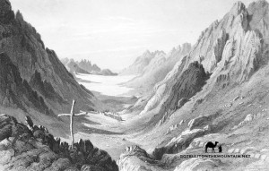 The Sinai might be little-known, but it’s not untrodden; or unexplored. As the great land-bridge between Africa and Asia it has been settled by many peoples in history and each walked into remote parts of it, looking for what they needed to survive. The Pharaohs scoured the western mountains of the Sinai looking for copper and turqouise and the Nabataeans left graffiti and even a small temple on the top of Jebel Serbal, one of its highest peaks. Some of most notable early explorers, at least in terms of documenting what they found, were the first Christian peoples of the peninsula. As the fabled setting of The Exodus, the Sinai had long been on the spiritual map for them and they began to arrive from the early centuries AD.
To begin with exploring the Sinai was about religion for the Christians. They wanted to pin down places in The Exodus legend and find the route Moses took to the Promised Land. They came, Bibles underarm, comparing Old Testament verse with the landscape to figure out what was where.
If you’ve read Exodus, you’ll know it’s not exactly forthcoming with detail.
The Christians had a big job trying to match Biblical prose with reality. Where things got hazy they had their faith to guide them but, of course, with this state of affairs, disagreements were inevitable and debates raged between them about what was really where. For some, the real Mount Sinai of The Bible was Jebel Serbal; a high mountain 60km away from the peak we call Mount Sinai today. Others said it was a mountain called Jebel Umm Shomer. Likewise, they argued about the route Moses took: where he crossed the Red Sea; which wadi he followed to Mount Sinai, and how he got to the Promised Land thereafter.
Some of these debates continued for centuries. And, although they might seem academic now, they were very real back then.
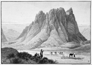 Actually, it was debates like this that really got people thinking about the Sinai and its landscape; walking in it, interrogating it, arguing about what was where and – in their opinion – WHY. People engaged with the Sinai’s geography in a new way and it was in these early interactions that knowledge about the Sinai was made and refined.
A huge bulk of this early knowledge remains with us today.
The Mount Sinai we climb now was put on the map by these early Christians. So too, the names of many other mountains, valleys and plains, all of which people still use to get around on a daily basis in the Sinai.
When the Biblical geography of the Sinai had all fallen into place – when their first mission of exploration was over – the Christians didn’t stop there. They continued to go into the wildest, most little-trodden parts of the peninsula. They built remote retreats for spiritual isolation all over the mountains; they laid paths in unknown valleys and established trade routes to connect the Monastery of St Katherine with trade ports on the coast. Even today, you’ll see the relics of these early pioneers in the most unlikely of spots.
In the 7th century, the Islamic Conquest reached the Sinai. The Monastery of St Katherine was given protection; but it went into a long, inevitable decline. Gradually, this era of exploration drew to an end.
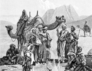 Bedouin tribes began to settle soon after the Islamic Conquest, with most arriving from the nearby mountains of Arabia. This began a new, equally important era of exploration. Like the Christians, they got to know the Sinai exceptionally well: to survive, they had to. They walked widely, finding the best routes through their new lands; the best places to for food, water and grazing. The depth of Bedouin exploration is reflected in the Sinai’s rich catalogue of place names: almost every part of the landscape – every mountain, valley, basin, spring, slope and well – has an Arabic name. These were like a mental map for the Bedouin: linguistic co-ordinates for navigating through the terrain.
We can’t say for sure where the Bedouin went in the Sinai; they were an oral people who didn’t keep written records. Place names don’t necessarily prove anybody went anywhere: but from what we know about the Bedouin and from what their own oral history records we can say pretty confidently they had most – if not all – the region covered.
Bedouin today might not know place names or the ways to places. But that’s not necessarily to suggest forebears didn’t; or that the Bedouin hadn’t been there.
Without any doubt, the Christian and Bedouin were the great explorers of the Sinai. The 18th century saw the start of European tourism to Egypt and the dawn of a new age of exploration. But this couldn’t be classed as exploration in the same way: Europeans were the explorers of an already-explored place and the Bedouin showed them around. Europeans couldn’t claim to be ‘explorers’ in the same vein as the Bedouin (although some did try). However, some Europeans did add something new and valuable: DOCUMENTATION.
Most European travellers in the Sinai came with little notebooks, recording place names, sketching maps and writing down their impressions; some of which were later published, and all of which still make fascinating reading.
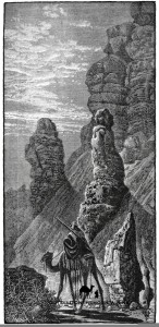 Amongst the most brilliant of these early explorers was Jean-Louis Burckhardt, whose claim to fame was being the first European to discover Petra. Fluent in Arabic, and often wearing the disguise of a Syrian merchant, he travelled through the most remote parts of the Sinai, covering its most remote wadis whilst re-discovering ruins and attempting new mountains. He even made an attempt on Jebel Umm Shomer – then believed to be the Sinai’s highest peak – but turned back below the summit crags. Burckhardt’s notes about geography, history and culture are the best early records of the Sinai and hugely improved outside knowledge of the area.
The next great European exploration of the Sinai came in 1869, with the British Ordnance Survey. This produced the first good maps of the Sinai – even though big parts of them were still just marked ‘ UNEXPLORED’ – and its photographers took the first images of the Bedouin. On top of that, they recorded previously undocumented info on the Sinai’s wildlife, geology, history, routes and place names; much of which is still referenced in modern works. This was the Sinai’s exploration document par excellence. And it still is.
A few decades after this, the emphasis of exploration switched again in the Sinai. It became less about individual explorers or survey teams working for academic goals. And more about knowledge, power, politics and control.
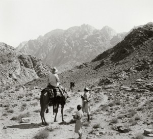 The British mapped the Sinai during their occupation of Egypt in the early 1900s; mostly for military ends. Maps were made in later decades by other powers, often for the same reasons. These map-making ventures of recent decades weren’t just different in their political objectives though. In terms of the actual exploration itself, recent surveys had little of the in-depth, on-the-ground exploration seen in earlier eras; many were done from aerial surveys and produced topographical information alone. The sort of stuff noted by earlier explorers: ruins, place names, legends etc. was all surprlus.
Many things remain virtually undocumented in the Sinai today. To some extent, it’s still possible to pick up where earlier explorers stopped.
But this isn’t as simple now. Modern generations of Bedouin don’t know the Sinai like their forebears. They don’t have the same intricate knowledge of it so in one way it’s harder to record such rich, useful information.
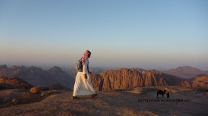 But as much as being the big challenge this should be the incentive to get out and record it. Some Bedouin – mostly the older ones – do know the Sinai well. It took centuries to build this knowledge up and it could be lost entirely if it isn’t recorded soon, which would be a big cultural loss. So as much as anything, the future of exploration in the Sinai is about re-discovering the past: it’s about recording knowledge produced in Bedouin explorations long ago – or filling in the gaps that were once known but then forgotten – and helping then preserve it for the generations of Bedouin that will follow.