A blog from the mountains of the Sinai

Category: Bedouin culture

Bedouin navigation in Sinai

Wadi Mileihis, Go tell it on the mountain, Ben HofflerThe Sinai has a reputation for being tricky to navigate. It’s the spot Biblical legend has it Moses got lost for forty years. History books report pilgrim caravans disappearing in the wilderness. Monks from the Monastery of St Katherine have gone wayward on mountain trails in recent times, as have hikers and inexperienced tour guides (who shouldn’t be guides at all). I often hear the Sinai described as a maze or a labyrinth (never by the Bedouin, always by outsiders) and I’ve heard people wonder awestruck at how the Bedouin navigate it, as though they must be possessed of a navigational sixth sense. At times, with the best Bedouin navigators, it can feel like they do have a sixth sense; but I’ll try and demystify exactly what that is in this blog post and how they do it.

There are a few things to say at the start. Firstly, although the Bedouin know the Sinai better than anybody in the world, they don’t all know it. The ones who know it exceptionally well and the best navigators are a small minority.

Most Bedouin know the Sinai averagely well at best (but it’s important to say this is still significantly better than the vast majority of outsiders).

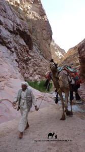
It’s also important to say it’s still a lot better than most younger Bedouin. Many Bedouin – especially those under 30 years old – know the Sinai much less well than the generations that went before them. Many of the younger Bedouin would get lost if they walked far today and I’ve been with some who have done exactly that, relying on their camels to guide them the remainder of the journey (camels, incidentally, are all-too-often unfairly denigrated creatures with an incredible memory of routes they’ve walked in the Sinai, but this is another story).

That’s the reality of Bedouin life in the Sinai today. Most Bedouin – especially the younger generations – live in a more modern world where knowledge about how to navigate – as well as knowledge on how to use plants for food or medicine or to track animals or even knowledge about their tribe’s own heritage and history – is becoming increasingly irrelevant to life and thus forgotten.

The 21st century is the great age of attrition for Bedouin knowledge.

Second, it’s important to say that – even with the most knowledgeable of Bedouin navigators – their knowledge is usually confined to their own tribal territory. Take them to the territory of another tribe and they’ll know it much less well. A tribesman of the Jebeleya tribe from St Katherine won’t know the lowlands of the Tarabin tribe half as well as he knows his own high mountains. He may know the main wadis and mountains of the Tarabinian lowlands and may be able to navigate these but he’ll certainly miss a lot of the detail in between. This plays out on a smaller scale too. Often Bedouin will know a specific part of their territory – such as the one where they grew up – better than other parts.

Most Bedouin navigation – at least in South Sinai – is done from memory.
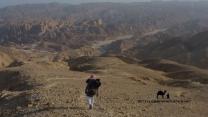
Nagb Matarsha, El Gardood, Sinai, Ben Hoffler, Go tell it on the mountainThe Bedouin grow up walking; they walk with their parents, then increasingly on their own or with friends seeing the same landscapes repeatedly over many years and developing a deep familiarity with their small details and secrets. Over the years they build up an exceptionally rich mental picture of their territory; of what’s where and how to get there. Its mountain peaks, wadis and basins all act like gigantic reference points. These never change: they remain constant signs and waymarks for a Bedouin finding his way. Similarly, smaller, permanent signs in the landscape – a rock, or a fig tree; or a mark in a cliff – give more subtle reminders about where to go, where to turn etc.

Sometimes, in places where navigation is tricky – e.g. a rocky, sandy areas across which there is no path – the Bedouin build trail marking stones called rojoms. You can see one rojom from the next, following them in a line through the difficult section. The best navigators won’t need these rojoms but they’ll be extremely valuable to the Bedouin who know the landscape at best averagely well. Following these is just like following a path (and of course there are plenty of paths in the Sinai, some of which are easier to follow than others, but all of which simplify navigating the mountain landscape considerably).

What about ways the Bedouin use to navigate indepedent of memory though? Independent of what they know from the ground itself?

In some parts of the Middle East the stars were key to Bedouin navigation, including parts of North Sinai. Here the stars and sometimes the horns of a crescent moon were important for navigating at night. Two stars were of special significance: Polaris (which the Bedouin call Al Jidi) and Canopus (which they call Suhayl). You’ll often hear references to these – and how they were used for navigation – in poems and stories. Polaris was a constant guide to north, visible all night, all year, whereas Canopus – which indicated south – was less constant; it wasn’t always visible and when it was it’d often remain on show just a couple of hours. But this was mostly in North Sinai.

Things were different in South Sinai. I’ve never seen a Bedouin use the stars in the south and although many older Bedouin will know how to find north and south from the stars I’ve only heard of the stars being used to find the way here in the most exceptional of places and circumstances.

There are several reasons why North and South are different in this respect.
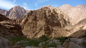
Wadi Sig bamboo thickets, SinaiGenerally, the stars are best for navigation in landscapes that can change – e.g. vast sandy deserts like the deep Sahara, where the wind can alter the shape of dunes, cover rocks and outcrops and blow any trails away. Or in landscapes that look the same; ones that are bereft of good landmarks and where it’s difficult to distinguish one part from the next, such as plains and low dunes common in North Sinai. The visual appearance of the land or at least human judgement of it can’t be taken as a good enough indicator of the way to go in these places which forces us to look outwards for other, more constant elements that give us more reliable guidance, like certain stars.

That’s different to South Sinai though. Unlike the North, this is chiefly a landscape of mountains and stony, rocky deserts with outcrops. It has a rich supply of markers that remain unchanging between the generations and which are ample to guide any good Bedouin navigator where he needs to go.

The Bedouin of South Sinai would have about as much reason to use the stars to navigate as a resident of Cairo would going between Zamalek and Maadi.

Simply, it’s unecessary. Better, easier things tell you the way.

Navigating with the stars also has serious limitations in a landscape that’s as intricate as South Sinai. Navigating here isn’t simply about identifying north and going for it in a straight line, like it might be in open deserts or plateaus or out on the sea. Big mountains get in the way in South Sinai. There are deep wadis to cross. There are high cliffs you can fall off. In landscapes like this the stars and the moon are more useful for the light they can throw over the landscape when they’re shining brightly rather than the directions they indicate. Getting through places like this is about micro navigating the intricate terrain of the mountains on routes that are winding, tricky and difficult to follow.

When I hear people say the Bedouin use the stars to navigate in South Sinai – especially now, in the 21st century – I know that i) either they know very little about the Sinai or the reality of navigation in it or ii) they do but they push this myth anyway because it sounds romantic and plays into outsiders’ – and especially Western outsiders’ – fantasies about who the Bedouin are and how they live that for whatever reason they want to capitalise on; it makes them sound exotic, with magical, esoteric skills, and an air of oriental mystique. I see this orientalising drive in bad travel writing and dodgy full moon party ads about the Sinai and – as appealing as it is to the imagination – the bulk of it isn’t true. Today, the reality is that many Bedouin – including some of its best navigators – are people who listen to mp3s, have smartphones and Facebook accounts; they watch TV shows, download stuff off the internet and spend hours on YouTube. And indeed why shouldn’t they? Why should this make them less Bedouin? Why should we maintain a description of the Bedouin that outsiders find romantically pleasing but which is out of date (assuming it was ever accurate at all)? Describing them in a more accurate and up-to-date way bursts the romantic vision many have but perhaps that isn’t a bad thing.

Up until now then it’s clear that – in South Sinai – the Bedouin navigate chiefly by getting to know specific areas exceptionally well; by building up a very rich mental map over many years that out-competes what anybody else could have and recognising the signs that mark the way.

It all sounds very visual and most of the time the vast bulk of it is.

Perhaps what sets the very best Bedouin navigators apart is their ability to use other senses – ie senses apart from sight – to know the way. Sometimes, this is necessary; especially in the high Sinai mountains, which can be hit by poor weather. Sometimes, mist and cloud whip across the mountains, reducing visibility; even so, visibility is very rarely so poor that a Bedouin navigator wouldn’t be able to see what was needed to make judgements about where to go. The worst conditions I’ve seen in the Sinai were on top of Jebel Katherina in freezing weather at night when visibility was just a few metres ahead.

Weather like this makes navigation much more serious. It makes it harder and it introduces a more unknown element into the equation which can spook some people and lead them into making bad decisions.

Nevertheless, a good Bedouin navigator would still be able to get through this. He will be slower; he will need to think and focus more, but the very best will nevertheless be able to deal with it and find his way through.

So how does he do that if he can’t see where he’s going?

Again, it all comes back to that exceptionally rich mental map a Bedouin has of a particular area: without sight, he needs to rely on other senses to interpret that map and locate his position on it. Whilst he might not see the ground he’s standing on, as he moves over a mountainside he’ll be able to feel the contours of the slope he’s on with his feet and balance: he’ll be able to feel where it gets steep and where it becomes flat; similarly, where it gets smooth, or rough, or where he walks onto scree. Each of these pieces of information is key and he will be able to use them to locate himself and proceed correctly. If you closed your eyes in your house and focused, you might be able to slowly find your way to the bedroom, feeling your way, using the same basic principles. It would’t be as easy as doing it with your eyes open, but it would be possible.

As well as the sense of touch the best navigator – again through his experience of having walked these landscapes so many times will have a sense of distance and timing built into his mental map. He will know how long it takes and feels to walk from one part of it to the next, even when doing it more slowly – for example in bad weather – and will be able to get a sense of where he is.

These techniques are similar – if less formal and exact – to the ones we’d use in the West to navigate in low visibility conditions.
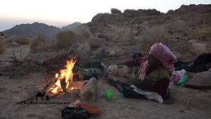
Bedouin with fire, Ben Hoffler, Go tell it on the mountain, Jiddet el alaWhen you wonder how the Bedouin navigate the Sinai – and I mean South Sinai here – remember, it’s chiefly about an extremely rich mental map. It’s about building up that map over many years and being able to interpret it intelligently through different senses as required. The way the Bedouin seem to ‘know’ the way even in the night or difficult weather might seem magical: but I hope this shows a bit of how it’s actually done. As for how outsiders in the Sinai, for all but the most experienced navigators you’ll generally need to use other methods (guidebooks, maps, GPS, Google Earth or a combo of these). Really though, the best plan is to use one of the best Bedouin guides/ navigators; because when you really need them, they are about as good as it gets keeping you safe through the Sinai. Nothing else comes close.
Continue Reading

Old ways to St Katherine

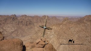
Crucifix, Sinai, Go tell it on the mountain_resultStand by the Monastery of St Katherine today and look around – swivelling through the full 360 degrees – and you’ll see high mountains locking you in on every side. Leave the monastery behind and venture up these mountains, heading for the very highest tops, and another – even more spectacular – view unfolds. A vast desert wilderness stretches out all around you, merging into the haze of faraway horizons. Sometimes, you can even see the high places of Africa and Asia. It’s a view that gives a sense of the Sinai’s epic isolation – the great no man’s land between continents – and of the Monastery of St Katherine; which stands in the most isolated part of the Sinai itself. Visiting the monastery today is easy – you can drive right up to its front gate – but getting here once required a long, gruelling camel expedition through remote stretches of wilderness.

The monastery might have been isolated, but it was still accessible. Travelling routes converged on it from all sides; some from Cairo, others from El Tur – an important port – and others from Jerusalem. Pilgrims, traders, travellers, warriors and poets all followed these ways before. And you can do exactly the same today.

Here are my five favourites – the best hiking routes to St Katherine.

Wadi Isleh, Go tell it on the mountain_result1. WADI ISLEH One of three big wadis that cut through the gigantic chain of mountains that run down the Sinai’s west coast. It’s spectacular from the start – a canyon whose walls rise vertically to the sky. Waterfalls gush and palm trees stand buried to their heads by the sediments of old floods. This was the way from the old port of El Tur – (today’s capital of South Sinai) – and the main route upon which supplies reached the monastery. It became important after the Islamic Conquest, when other routes became difficult. It takes 3-5 days and is best done in spring, so you see the waterfalls at their fullest. Water in the desert always has a magic about it.

Wadi Sig Sinai, Go tell it on the mountain_result2. WADI MIR This gives an alternative way through the massive chain of mountains on the west coast. You soon get to a junction in the wadi where two routes diverge. One goes to Wadi Sig – my favourite wadi in the Sinai – whilst the other crosses a high pass known as Naqb Umm Seikha. This was the fastest, most direct route and as such the one along which post travelled to St Katherine (it was called Darb el Bosta – The Post Road). It’s another way in from El Tur – and to save your energy, you can even get a jeep a few kilos up the wadi. It takes 3-5 days to St Katherine but – be warned – it’s tougher than Wadi Isleh.

Naqb el Hawa, Go tell it on the mountain_result3. WADI HEBRAN The third of the big three wadis cutting into the Sinai’s huge western chain of mountains. It’s full of greenery and was the wadi through which Abbas Pasha – an old ruler of Egypt – planned a road to St Katherine. Today, talk of making a new modern road has resurfaced, which is all the more reason to walk it now. You have two options: you can exit the wadi on a route that connects to the old pilgrim route of Naqb el Hawa: Pass of the Winds. Alternatively, you can continue to Wadi Kabrin – a beautiful red rock wadi with Christian graffiti and hermit cells. Either way, give it 3-5 days start to finish.

Serabit el Khadem, Bedouin guide, Go tell it on the mountain_result4. DARB MUSA – the ‘Way of Moses‘. This is the legendary way to the Monastery of St Katherine from Suez, re-tracing the way it’s said Moses escaped the Pharaoh Ramses. It was the major route upon which travellers walked to the Monastery of St Katherine in times past and is recorded in several early guidebooks. Travellers would visit ‘Stations of the Exodus’ on the way – where it’s said Biblical stuff happened. Today, it’s best not to start in Suez; but in Wadi Gharandal, where Wadi Wutah gives a beautiful passage through the Wilderness of the Wanderings to Wadi Feiran and St Katherine. Give it 7-10 days all the way.

Ras El Qalb5. THE JERUSALEM ROUTE The route carried a steady flow of pilgrim traffic – connecting two major Christian sites in the Middle East. It entered the Sinai from the Negeb – the Sinai’s Bedouin sisterland to the north – and ran into Wadi Watir (which has a tarmac road today – but which is still beautiful). There were two routes into Wadi Watir – one down the coast from Taba – and another from further north. Thereafter the main route passed Ein Hudera; a green oasis with pilgrim graffiti. Today, a variation on this route is being re-made as the Abraham Path and will soon be ready. Give it 10-12 days to walk the whole thing end to end.

Remember all of these routes are walkable but they go through remote, isolated stretches of wilderness where help can be a long time coming if needed – so a good, experienced Bedouin guide is key to success. Going with the Bedouin is the smart move and it will add a whole new dimension to your trip. You won’t just get to know the way – you’ll really understand the desert and how to survive it. As well as a guide you’ll need to take a jeep to the beginning of most of the routes marked here. For the first three wadis the best place to start from is El Tur. For the fourth, you’ll need to get the jeep to Wadi Gharandal. Check out the best guides and jeep drivers in my Directory of the Best. Most of them will know the routes here and if they don’t they should be able to link you up with other trusted guides who will.

Continue Reading

The Sinai: cool places to sleep

Bedouin with fire, Ben Hoffler, Go tell it on the mountain, Jiddet el ala‘Spread a blanket beneath an apple tree and it’ll only gather apples’ wrote French author Antoine de Saint Exupery in Wind Sand and Stars. ‘Spread a blanket beneath the stars’ – he carried on – ‘and it’ll gather the dust of stars’. Like the Bedouin, he was a man who loved the desert; especially at night. He liked to lie back, face to face with the universe, gazing up at the glittering heavens and immersing himself in a picture of eternity. I’m sort of like that. Sleeping under the stars – out in the open, without a tent – is about as good as it gets for me. The Bedouin call it the ‘million star hotel’. And I’m totally with them. When I go back to sleeping inside I feel trapped with a roof over me. Tents can be good sometimes – like in winter – but I still don’t usually carry one. Neither do the Bedouin. They like to travel light, finding shelter if they need it. And sometimes, you DO need it. Sometimes it’s cold or windy or raining or whatever.

Luckily, the Sinai has plenty of shelter. A cave, an old shepherd’s house; a hermit cell, a rock with a hole under it. Basic – yes but with a beautiful, epic, lost age feel.

So here are the COOLEST places to sleep if you’re on a hike:

Ghoul's Cave, Sinai, Ben HofflerCAVES – there’ll always be something cool to me about sleeping in a cave. I actually enquired about renovating and living in a cave near St Katherine once (alas, it didn’t work out). Sleeping in a cave puts you inside the landscape. It makes you feel part of it. Caves are always atmospheric, especially with a fire at night. The cave in the pic is Kahf el Ghoula – The Ghoul’s Cave – on Jebel el Rabba. It’s OK but a bit damp and if anything too big to really get warm. My favourite caves to sleep in are in Wadi Maghara, near Wadi Feiran; actually, they’re not caves, they’re ancient mines from Pharaonic times. They’re great shelter and gaze out over a beautiful sweep of mountains.

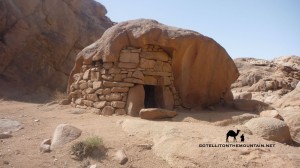
Hermit cell, Sinai, Go tell it on the mountain_resultHERMIT CELLS – these might be the Sinai’s best spots to sleep. They’re basically boulder houses built over a thousand years ago by Christians seeking refuge and solitude in the wilderness. Some are more advanced than others, like the one in the pic. You can see my red bag next to the door. Walk in and there’s a big porch where you can leave your stuff and make a fire. Crouch down and a little wooden door lets you into the main chamber which has sleeping platforms, shelves and air vents. It’s near Jebel Bab el Dunya and I slept here for two nights in a heavy snowfall in December 2013. There are other good ones on Jebel el Deir, Mount Sinai and in lots of other secret mountain spots.

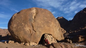
Boulders, Wadi Kidd, Go tell it on the mountain_resultHOLLOWS & HOLES– go to the desert parts of the Sinai and you’ll find landscapes with a surreal, Salvador Dali type vibe. Some of the rocks look like they’re melting in the sun, with strange droops in their sides and psychedelic swirls of colour. It’s all because of the way the sandstone erodes here; occasionally, the erosion creates bigger hollows into which you can crawl and use as sleeping pods. Some even have holes in the side, like windows. The best are on Jebel Mileihis. But they’re hidden well – so you’ll have to hunt. Higher in the mountains, you don’t usually get the same sort of thing; the closest equivalent are holes under big boulders, like in the pic above.

Rock shelter, Farsh Umm Silla, Sinai, Go tell it on the mountain_resultBEDOUIN SHELTERS – the Bedouin built an extensive network of shelters in the Sinai. They’re like hermit cells but they’re not usually as ancient and the Bedouin didn’t live in them long term either. They were built for Bedouin travellers or for ibex hunters – who still use them today. There are also old storehouses, which the Bedouin used for storing brushwood and provisions for when they needed them. They’re well hidden and just look like a small door in the cliff. Storehouses are usually a bit small; but if you really need shelter you can still squeeze inside and use them. My favourite shelter is near Jebel el Thebt; a totally hidden boulder house in a remote, windswept wadi.

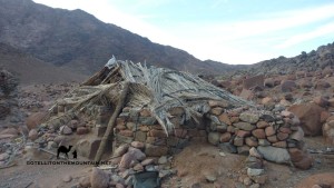
Sinai hut, Go tell it on the mountain, Ben HofflerHUTS, HOUSES & RUINS – OK, a hut doesn’t have the rugged charm of a cave, but these are still pretty cool places to sleep. Some huts are owned by the Monastery of St Katherine and usually have a crucifix on the door. There are old Bedouin houses too; four stone walls with a palm fond roof, still sometimes used. If you find people inside, they’ll always welcome you the Bedouin way. I reckon the best are in Wadi Sigillia, a wadi with waterfalls. Finally, look out for old ruins. Few have roofs but they give good windbreaks. And you sleep inside history itself. Not many folks can say they’ve slept in a Byzantine monastery or Ottoman Palace – unless they’ve been to Sinai…

Finally: an obligatory word to the wise. Shelter in the Sinai isn’t always easy to find; often, it’s hidden, because the Bedouin like it that way. You can walk past an amazing shelter, mistaking it for any old rock. Most of the Bedouin know where shelter is because they know the area. If they don’t, they know how to find it. Or make it. Before hiking without a tent – which gives cover anywhere, anytime – check the weather forecast and know where the shelters are. As well as knowing where the shelters are also know how to find or make one in an emergency. There’s nothing better than a good Bedouin guide to keep you safe – so do your research and use one. Finally, remember to leave shelters as you find them; and, if you can, to leave some useful stuff behind – e.g. sugar, tea, wood – because you never know, the people who follow you might really, really need it…

Continue Reading

Five holy peaks of the Sinai

Mount Sinai peak, sunsetMount Sinai is the spot they say God spoke with Moses, giving the 10 Commandments. It’s the Sinai’s holiest peak. You could make a good case for it being the holiest in the world too. Holier to more people, in more parts of the world, over a longer time, than any other mountain on earth – which is really something. It isn’t the Sinai’s only holy peak though. There are plenty of others. Some of them are holy because – like Mount Sinai – they’re on the Biblical map. Others, because of later miracles. And some were holy in much more distant eras, to much earlier peoples of the peninsula, whose religions we know little about today. Here are five holy peaks of the Sinai you rarely hear about:

1. JEBEL SERBAL Jebel Serbal looks amazing. If you had to say any peak in the Sinai was holy based on looks alone, it’d probably be this. And for a long time, people did say it was holy. Some scholars reckon the name Serbal comes from ‘Baal’, a pagan God who was worshipped in these parts of the Middle East in ancient times. There’s a little ruin on the mountain top that dates from a later era, which archaeologists reckon was a Nabataean temple. Later still, in Christian times, Jebel Serbal took on a whole new association. Early Christians believed it was the real Mount Sinai of The Bible – i.e not the peak we call Mount Sinai today. The ruins of the Sinai’s first episcopal city, plus hermit cells, chapels and crumbling stairways, still stand around the mountain today.

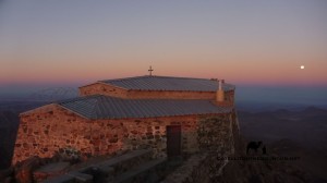
Jebel Katherina, summit chapel, Go tell it on the mountain2. JEBEL KATHERINA Egypt’s highest peak. Legend has it angels carried the body of St Katherine here after the Romans killed her in Alexandria. The exact whereabouts of her bones remained unknown until one day in the 9th century when, claiming all had been revealed in a God-given dream, a local monk wandered up the mountain and found them on this summit (the lower of the mountain’s two high points and the second highest point in Egypt 2637m). Ever since then, this peak has been hallowed ground. There’s a small chapel on top but the bones of St Katherine are now in the Monastery of St Katherine.

3. JEBEL TAHUNA A little peak in Wadi Feiran, local legend has it Jebel Tahuna is the spot where Moses watched the Battle of Rephidim, raising his magic staff to spur the Israelites on to victory. A 1500 year oratory crowns the summit, with a near-perfectly preserved water cistern dug into its foundations. Small chapels, whose walls, columns and altars are all still visible, stand by the path up the mountain. Hermit cells are dug into banks along its lower slopes and the higher hillsides are scattered with ancient Christian tombs. Travellers have been climbing this peak for  centuries, and you should too. As much as the history, it’s worth it for the beautiful views you get over Wadi Feiran – one of the Sinai’s biggest, most beautiful wadis – and of Jebel Serbal, towering up like a castle.

Jebel Moneija from Mt Sinai, Go tell it on the mountain_result4. JEBEL MONEJA A lot of tourists climb this, making the mistake of thinking it’s Mount Sinai. Actually, it’s just a smaller, sister peak, half way up. It’s also called Jethro’s Mountain, after Jethro, the Biblical figure, whose daughter is supposed to have married Moses. Monks say God spoke to Moses here, beckoning him further up the mountain, and it’s another of the Sinai’s holiest spots. With a chapel on top, this is a brilliant peak with what is – in my opinion – the best view of the Monastery of St Katherine in the Sinai; the classic  viewpoint from which artists sketched it, huddling below Mount Sinai, for centuries.

5. JEBEL EL AHMAR Sometimes also known as Jebel Moneja – like the peak above – this is a little-known summit in the northern foothills of Jebel Serbal. It isn’t as dramatic-looking as the other peaks here, but all the same, this was one of the Sinai’s holiest summits for a long time. Early explorers recorded it having a special place for the local Bedouin of Wadi Feiran. They’d make pilgrimage trips to a shrine on the top, tying rags, beads, camel reigns and other offerings to the stones. That’s stopped today, but I’ve still heard people talk about it in the past. If you go you’ll have a spectacular view over Wadi Feiran, with its big palm grove; and one of the best views of Jebel Serbal. You can also visit the tomb of Sheikh Shebib, a holy saint of the Gararsha tribe, at the foot of the peak.

Continue Reading

The Ghoul’s Cave: Merry Xmas

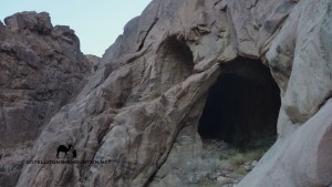
Ghoul's Cave, Sinai, Ben HofflerKahf el Ghoula – The Ghoul’s Cave – is a dark, foreboding cavern in the side of Jebel Rabba. It looks like a black eye on the mountain, peering down on the wadi below. Legend has it a ghoula – an evil witch type creature – used to live here. She’d spy out travellers in the wadi. Then she’d capture them; and eat them, leaving a pile of bones. Bedouin mothers still tell young children stories about the  ghoula to stop them wandering into the mountains alone. Anyway, it’s a beautiful, atmospheric cave, and we went to celebrate Christmas there this year; it feels sheltered, faraway and mysterious, deep in the mountainside. Definitely a hideout fit for a ghoul, if ever I saw one…

Getting there is easy – its about half an hour’s walk from St Katherine.

Christmas, Sinai, Ben HofflerYou just need to walk out of town through Wadi el Arbain. About 10 minutes along a ravine runs up into the mountains on the right hand side: this is Wadi Abu Heiman and Kahf el Ghoula is on the right side of this ravine, about a 15-20 minute climb.

There’s a spring in the cave, where water seeps out of the mountainside; green maidenhair ferns grow around it. They call it Ein el Ghoula – Spring of the Ghoul – and you can still drink its cold, fresh water today.

The Ghoul's Cave, Wadi Arbain, SinaiLook out for the small, cubby-hole type cave near the main one. It’s a person-sized cave where people say the ghoula would keep her victims before she ate them; a sort of larder to keep them fresh. You can climb up to to have a look, but it’s a little bit tricky.

Anyway, there aren’t many caves in the Sinai so whenever you find one – especially one this big – it’s worth a look. Merry Christmas from the Sinai!

Continue Reading

The blog: how it all began

THIS ARTICLE FIRST APPEARED IN EGYPTIAN STREETS. Check out their website HERE and like their Facebook page HERE!

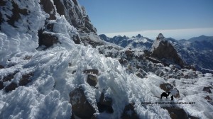
Ice crystals, Jebel KatherinaWhen it comes to mountains and the Middle East, a few countries might spring to mind. There’s Yemen, with its pretty mountain villages and the highest peak of the Arabian peninsula; Oman too, home to the mighty Al Hajar range. In the wider Arab world, there’s Morocco, with the high, snowy peaks of the Atlas. Egypt has mountains too – lots of them – but it’s not famous for them in the same way other countries are. Few outsiders see Egypt as a mountain country. And mountains aren’t really part of the image Egyptians project about their country to the world either; they’re not woven into the national identity like the Nile, or even the sweeping deserts along its banks. Mount Sinai might be famous; but it’s a single peak. Beyond this and perhaps a couple of other iconic summits the mountains of Egypt are little-known; much less actually visited.

The mountains of mainland Egypt are amazing; on the Libyan side of the Nile, there’s Jebel Uweinat; on the other, the Red Sea Mountains.

But perhaps the most amazing of all are those of the Sinai.

The Sinai is Egypt’s great mountain land; a rugged wilderness where peaks tower up to gaze over the Red Sea to Africa and Asia. Egypt’s highest mountains are found here. But it’s not the height alone that makes them special. They’re some of the world’s most fabled mountains; the setting for ancient Biblical legends that are still told today. And there’s the history too; relics from the times of the Pharaohs – and even more distant eras – are still scattered by old paths.

I took my first hike in the Sinai over six years ago now.

Jebel Katherina, summit chapel, Go tell it on the mountainLike most would-be hikers, I started out on a familiar path; doing the best known peaks at the beginning. I did Mount Sinai first – the most written about, talked about, and easily the most-climbed peak anywhere on the peninsula – and then Jebel Katherina, whose main claim to fame is being Egypt’s highest mountain. After that, I moved on to the sort of peaks that aren’t very well-known outside the Sinai – but which are still well-trodden within it – like Jebel Abbas Pasha, which has an unfinished Ottoman palace on top, and Jebel Umm Shomer, Egypt’s second highest mountain. After those, I began moving further out to the more rarely visited areas, seeking out the most little-trodden peaks.

Whether you walk a famous or a lesser-known peak, the Sinai’s rarely easy.

Good paths are hard to come by. There are virtually no signposts. Nor easy, end-of-the-day conveniences. The infrastructure for hiking tourism just hasn’t been widely built up. Good maps are pretty much non-existent. And whilst it’s good for some areas in the Sinai, Google Earth doesn’t cut it for navigating intricate mountain routes. As much as anything, there’s a dearth of information – good written information – about many parts of the Sinai’s mountains.

Sometimes, you can delve back into the travelogues of European explorers.

They might be old, but they’re usually still useful. These explorers walked more widely than any contemporary author; and a lot of the time their records are the only ones available for parts of the Sinai.

Amongst these early explorers was Jean Louis Burckhardt, who won immortal fame for unveiling Petra to the West. He travelled through the Sinai in 1816, walking widely and climbing a few iconic mountains.

There was Edward Henry Palmer too; a Cambridge professor who wrote a remarkable travelogue featuring many little-known parts of the Sinai.

And George Murray; a highland Scot and born mountain man who climbed some of the Sinai’s hardest peaks; and others across Egypt.

Of course though, these explorers didn’t go everywhere. Or record everything.

Camping in Sinai, Go tell it on the mountain_resultFor large areas of the Sinai, there are still no written records. No modern ones; or older ones. Walking in these areas – in the most little documented parts of the Sinai – is a process that beings simply by asking questions. Specifically, by asking questions of the local Bedouin. The Bedouin arrived in the Sinai from the Arabian Peninsula centuries ago and walked the mountains widely from the start, looking for water, food, grazing and other essentials they needed to survive. They built up a huge bank of knowledge about its mountains through the ages. They were the Sinai explorers par excellence and their knowledge is still the only source of information available about a lot of the peninsula. When European explorers came to the Sinai they only ever explored it through the Bedouin, even if the Bedouin didn’t feature much in their written accounts. They had Bedouin guides; and they recorded Bedouin knowledge.

But Bedouin knowledge isn’t what it once was. Lifestyles have changed.

Today, many Bedouin have left the mountains for new towns and villages on their fringes. Knowledge about the mountains – once central to survival – is largely irrelevant now. And because it’s not used, a lot of it’s being forgotten.

You can see clear gaps in the knowledge of younger Bedouin already.

It’s the older Bedouin who know the Sinai best. But even then, tracking down the ones who know the ways up the hardest, most little-trodden peaks is a challenge. Sometimes, it can be simpler to just re-discover the routes from scratch.

This dearth of good written information about the little-known peaks of the Sinai is a hindrance to anybody wanting to do them. And to the development of hiking generally. I still experience it today. And it’s something I’ve tried to address through several projects. Earlier this year, I finished a trekking guidebook to the Sinai, published in the UK. It gives the best, most classic walks in the peninsula and the practical information needed to organise them.

More lately I created the website Go Tell It on the Mountain.

This is a project with a more specific mountain focus. And one which aims to start a grassroots documentation process. To begin a simple list of peaks – from the most famous to the most little-known – that will grow into a bigger bank of information that can be used to go deeper and discover more.

But it’s not just about showing what mountains are in the Sinai.

Camping in Sinai, Go tell it on the mountain_resultIt records a more personal journey that I hope might help change perceptions about the peninsula. Over the last few years there has been a near constant stream of bad news from the Sinai; most of it from the North. But all too often North Sinai has been conflated with South Sinai; the peninsula portrayed as an undivided, unvariegated whole. Sinai is just Sinai. In reality the two areas have big geographical and social divides and South Sinai – which is where the mountains are – has been largely peaceful. Along with the bad press, Western governments have issued travel warnings for South Sinai, which have only reinforced perceptions of it as a place of danger. And even when warnings have been lifted for South Sinai resorts like Sharm they have remained in place for the mountains. The official message has been clear for years – don’t go.

It’s a state of affairs that has undermined the tourism upon which many local communities have grown to depend. Many are seriously struggling.

This website is about creating a counter-narrative to the bad news.

It’s about putting an alternative voice out there and showing a more real, everyday side to the mountains. It’s about telling stories that show these mountains are home to an ancient Arab culture built on honour and hospitality to travellers. And that these traditions still hold strong today. Ultimately, it’s about showing that you can travel safely here – even in the most little-visited parts of South Sinai’s mountains – despite what they say.

My biggest hope is that tourism will return; and not just to those parts of the Sinai that had it before. But to the most little-trodden mountain areas.

Jebel Rabba, Sinai, Go tell it on the mountainThe Bedouin have always supplemented traditional livelihoods by guiding travellers in their lands; from traders to pilgrims and early explorers. Mountain tourism like hiking – which has proved so successful in other Arab countries – would be a sort of modern re-incarnation of that, creating a type of work that plays to natural Bedouin strengths in a way the Sinai’s glitzy beach resorts never could. It wouldn’t just open up a new treasure trove of beautiful mountains for the world; it would drive local development. And it’d put down a financial incentive for the preservation of Bedouin knowledge about the mountains. Knowledge it took centuries to build up and which – once lost – could never be re-created the same again. Knowledge that shouldn’t just be seen as part of Bedouin cultural heritage; but as part of humanity’s heritage at large.

My plans for the future are to carry on hiking in the Sinai. There are still new mountains I want to do. And old ones I want to try new ways. And I’d encourage anybody who’s in two minds about going to the Sinai to visit too.

The mountains of the Sinai and amazing and safe to visit in the South. If you don’t want to go alone, small hiking groups have been active for years. New ones are springing up too, run by Egyptians and foreigners. I’ve seen more hikers in the mountains this year than any previous one too. It’s all grounds for hope; a sign things might be going in the right way. Once people start walking more in these mountains; going deeper and bringing their stories back it’ll become clear that Egypt isn’t just the equal of Arab neighbours like Yemen, Oman and Morocco when it comes to mountains. But that it’s the equal of anywhere in the world. And perhaps then – when the epic potential of these mountains becomes clear – it’ll be the base for more change and development.

THIS ARTICLE FIRST APPEARED IN EGYPTIAN STREETS. Check out their website HERE and like their Facebook page HERE!

Continue Reading

The legend of Jebel Banat

Serbal view, Go tell it on the mountainThe Sinai has two Jebel Banats; one of them’s near St Katherine; the other, near Wadi Feiran. Jebel Banat means Mountain of the Girls and they’re both beautiful peaks with epic views. The Jebel Banat in Wadi Feiran has an added attraction though: a story. And if anything pulls me to a peak as much as the beauty, views and adventure, it’s a story. And this isn’t just any story; it’s one of the Sinai’s most famous. One the Bedouin were telling centuries ago. And one which is still being told today; I’ve heard everyone from Bedouin guides to taxi drivers and ibex hunters tell it. Like all good stories, it has a message. One they say helped improve the rights of local Bedouin women. One that’s maybe still relevant. It’s about two Bedouin sisters, from Wadi Feiran…

The father of these sisters wanted them to marry two men he’d chosen for them; but the sisters didn’t like them. So they said no. But he insisted. After that, they ran away and hid in the mountains. Someone spotted them though. Then told their father where they were. He went to get them but the girls saw him coming and climbed the mountain. Up on the high cliffs, they tied their hair together, then jumped. They died in front of their father.

Death was better than an unhappy marriage.

You might hear the story told in slightly different ways – the richness of the spoken word – but that’s the gist of it. People say it’s true; I’m not sure when it’s supposed to have happened; but it’s definitely OLD. The first recorded version I’m aware of was published back in 1816.

Jebel Banat, from Jebel Salla, Go tell it on the mountain_result

Anyway, Jebel Banat is a peak that hikers virtually never visit; but it’s beautiful and well worth a climb. Start in Wadi Feiran. Public buses pass through on the way from Cairo or St Katherine so getting here isn’t too tricky (11am from Turgoman, Cairo). Find a guide in Wadi Feiran, asking in local Bedouin gardens. To get to the mountain itself you’ll begin in Wadi Nefuz. This soon becomes a dramatic gorge – a beautiful walk – but you can avoid the gorge with a shortcut too. Both ways meet later then go up to a flat area called Farsh Tibeina. From here, it’s an easy scramble to the top. I looked around the top for any cairns, graffiti or memorials for the sisters but didn’t find any. Maybe the greatest memoria of all though is that – whoever the sisters were – their story is STILL being told. They died but, in a way, they’re still alive…

Continue Reading

Wadi Zelega Camel Race

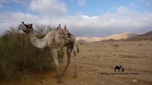
Wadi Zelega CamelEvery year, sometime in early January, Wadi Zelega is transformed from an ordinary desert wadi into a rugged race track for the annual Muzeina vs Tarabin Camel Race: the biggest event in the Bedouin sporting calendar. The Muzeina and Tarabin are two of the Sinai’s biggest tribes and this race goes back a long way. I don’t know exactly how long, or the full story behind it, but a Bedouin man told me it started when a boy of the Tarabin wanted to marry a girl of the Muzeina. Apparently, neither tribe wanted the marriage and it was thus agreed it’d proceed ONLY if the Tarabin boy won a camel race against the best riders of the Muzeina. Against all expectations, he did win. And ever since then, the race has been an annual fixture.

For local Bedouin, camels are a HUGE source of  pride and derbies are fiercely contested. As a spectator, they’re the most authentic events you can see. There’s nothing staged about them. They’re REAL; by locals, for locals.

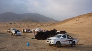
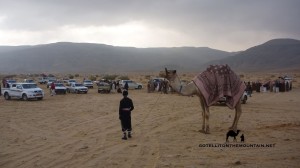
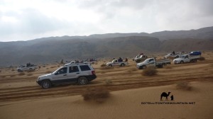
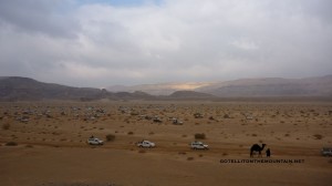
Bayt el Shar, Wadi ZelegaThis year – after missing it every other one – I HAD to see the race. I woke at dawn and got a jeep to Wadi Zelega with a few Bedouin friends from St Katherine: all long-time camel enthusiasts who’d make the perfect racing company. Bedouin camps were scattered all over the wadi when we arrived; traditional goat hair tents were rigged up near Toyota pick-up trucks and small groups of men huddled around fires making tea.

I’d never seen so many Bedouin in one wadi. It’s how the old times might’ve looked, when tribes migrated together, in bigger groups.

Anyway, over where the camels stood, there was a big hullaballoo.

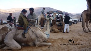
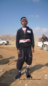
Bedouin jockey, Wadi ZelegaA debate was raging about whether to hold the race or not. It had rained in the night and the sand was heavy and stodgy in places. Further along, pools stretched across the wadi. It all meant danger for the camels who – running at top speed – could easily stumble and break a leg or worse. More than that, it was dangerous for the jockeys; invariably small Bedouin boys, as young as seven or eight. Being thrown off the top of a sprinting camel could be nasty.

Anyway, it was eventually decided the race WOULD be run.

And that – inshallah – everything would be OK.

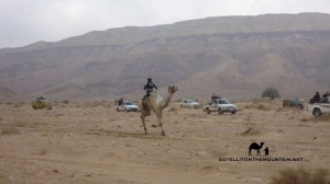
Wadi Zelega raceThe camels were led to the start line as the jockeys were lifted up onto the saddles. They whispered last words to their camels as their fathers spoke to them and a long-winded Sheikh roared orders out over everybody through a megaphone. There was a bit of jostling on the start line before an AK47 was fired in the air. Then – with a sudden thudder of hooves – the camels were away, galloping off towards the horizon.

We legged it back to our jeep, pushing our way through the crowds and piling in the back as our driver simultaneously floored the pedal, throwing us all back in a heap against a half-open door. I staggered back up – feeling slightly dazed – and looked out of the window, only to see a Toyota pick up truck drive head first into a ditch. Another one missed a big retem bush with a last-minute swerve, sending three other jeeps into swerves too.

Wadi Zelega jeep raceWe were in Wadi Zelega, but it felt like we were in Days of Thunder; dodging ruts and boulders whilst overtaking jeeps, then cutting them up; whatever worked best. Looking out at the camels I began to wonder where the real race was. There – or here. From what I could see of the camel race, it was clear stuff was already changing.

A pack of leaders had pulled away. Some camels had slowed to a canter. Others had run into a no man’s land at the sides of the wadi. And some had stopped completely, with loose saddles, sores or other problems.

Wadi Zelega with a Bedouin 4x4sJust after the half way mark, our driver began a new manoeuvre, zig-zagging through lines of racing camels and jeeps from one side of Wadi Zelega to the other, then racing up a high promontory. Here, we got out and gazed out over the whole wadi. It looked beautiful: a wide desert wadi, with faraway skylines lit by the soft rays of the morning sun. Soon the wave of Bedouin jeeps surged through; the sound of beeping, shouting and the distant hum of engines all drifting up to us. From the ground, we could hardly see the camel race at all: here, we looked down from the sky, feeling like masters of it all.

We let the wave pass, then tore back to surf on its danger again.

Wadi Zelega, racing camelThe effects of the race were starting to show now. Some camels were foaming at the mouth; others had big, bleeding sores on their rumps from being whipped. They were going fast; not as fast as they had been. But still fast. At this stage it was all about endurance: this was the critical stage; the one where it’d all be won or lost. And, if ever there was a landscape for a moment of destiny – for a battle where every bit of power would be summoned for a last shot at glory – it was here, in the rugged wilds of Wadi Zelega.

On one side were the foreboding plateaulands of Jebel Gunna. On the other, Hadabat el Tih; a highland that stretches over the Sinai from one side to the other; the Bible’s epic Wilderness of the Wanderings.

The jockeys shouted at their camels, grinding out every bit of strength.

P1200769_resultThey all surged forward but it was a Muzeina camel that took the critical advantage; holding a straighter line and edging ahead until his rivals couldn’t catch him and he had a clear run to the finish. This camel crossed about a minute before the rest, finishing a 20km track in about 45 minutes. The Muzeina celebrated, waving their shemaghs in the air and firing their battered old AK47s into the sky. I just crossed my fingers and hoped no bullets came down on my head. Over the next 15 minutes, the rest of the camels came in too: all of them caught and deservedly congratulated for finishing the Sinai’s toughest race.

I’m still not sure whether the Wadi Zelega Camel Race is a proper camel race or just the pretext upon which the Bedouin get together for a MASSIVE annual off road rally and dust up. It’s sometimes fast, almost always dangerous; but whatever it is, it’s AMAZING FUN and a highlight of any year. No other event pulls the Bedouin together like this today: this is the only one where you’ll see so many in their traditional tents; the only one where they meet so many old friends and just do something – with each other – that’s as BEDOUIN as anything will ever be. It doesn’t have the money or glitz of camel races in the Gulf states: but it feels more real. It’s run with real Sinai camels, trained and run by local Bedouin etc. I’ll definitely be going in 2015. But perhaps with a crash helmet…

Continue Reading